Area Overview for GU34 1RH
Photos of GU34 1RH


Area Information
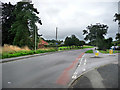
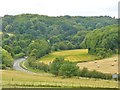
Living in GU34 1RH means being part of a small, tightly knit residential cluster in England, home to 1,691 people. This area is characterised by its compact size and the presence of family-oriented housing, reflecting its appeal to middle-aged residents. Daily life here is shaped by proximity to essential services, including retail outlets, rail links, and schools. The community benefits from strong digital connectivity, with broadband scores near 100, ensuring seamless internet access for both work and leisure. While the area lacks large-scale amenities, its practical reach includes local shops, railway stations, and a nearby airport, offering a balance between convenience and tranquillity. The demographic profile suggests a stable, mature population, with a focus on home ownership. For buyers, this postcode represents a blend of practicality and accessibility, ideal for those seeking a quieter lifestyle without sacrificing connectivity to nearby towns and services.
- Area Type
- Postcode
- Area Size
- Not available
- Population
- 1691
- Population Density
- 2444 people/km²
GU34 1RH is primarily an owner-occupied area, with 64% of homes owned by residents rather than rented. The accommodation type is predominantly houses, indicating a focus on family homes or larger properties. This suggests a market where buyers are likely to find established, private residences rather than apartments or rental properties. The small size of the area means the housing stock is limited, so buyers may need to consider nearby regions for more options. The high home ownership rate reflects long-term residency and stability, which could be appealing to those seeking a secure investment. However, the limited number of properties also means competition may be fierce, and buyers should act promptly if they find a suitable home.
House Prices in GU34 1RH
Showing 1 properties
| Address | Type | Beds | Baths | Last Sale Price | Last Sale Date | |
|---|---|---|---|---|---|---|
| Alton Day Service, Chawton Park Road, Alton, GU34 1RH | commercial | - | - | - | - |
Energy Efficiency in GU34 1RH
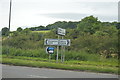
Residents of GU34 1RH have access to a range of amenities within practical reach. Local retail options include M&S Alton, Iceland Alton, and Sainsburys Alton, providing essential shopping and grocery needs. The area’s rail links to Alton and Bentley stations offer easy access to nearby towns, while metro stops at Medstead & Four Marks and Ropley connect to broader regional networks. Lasham Airport, though not a major hub, may serve specific travel requirements. These amenities contribute to a lifestyle that balances local convenience with connectivity to larger centres, making daily life practical and efficient for residents.
Amenities
Schools
Near GU34 1RH are several educational institutions, including The Butts Primary School, which holds a ‘good’ Ofsted rating. This school serves the local community with primary education, offering a reliable option for families. Other nearby schools include Chawton Park Pupil Referral Unit, Whitedown School, and Lord Mayor Treloar Hospital School, all of which are special schools catering to students with specific needs. The presence of both mainstream and specialist schools provides a range of educational choices, though the area lacks traditional secondary schools. For families requiring specialist education, the proximity to these institutions is a significant advantage, while those seeking a broader range of schools may need to look further afield.
| Rank | School | Type | Entry gender | Ages |
|---|
Explore more schools in this area
Go to Schools tabDemographics
The population of GU34 1RH has a median age of 47, with the majority of residents aged between 30 and 64. This indicates a community skewed towards adults, likely including families and professionals. Home ownership stands at 64%, suggesting a stable housing market where most residents live in their own homes rather than renting. The predominant accommodation type is houses, reflecting a suburban or semi-rural character. The predominant ethnic group is White, with no specific data on diversity beyond this. The age profile and ownership figures imply a mature, settled population, with fewer young families or students compared to other areas. This demographic mix may influence local services and amenities, tailored to the needs of middle-aged residents rather than younger or older demographics.
Household Size
Accommodation Type
Tenure
Ethnic Group
Religion
Household Composition
Age
Household Deprivation
NS-SEC
Explore more demographic insights in this area
Go to Demographics tabPlanning
Planning Constraints
- Flood RiskPremium
- Ramsar Wetland SitesPremium
- Area of Outstanding Natural BeautyPremium
- Protected Nature ReservePremium
- Protected WoodlandPremium