Area Overview for GU34 1AF
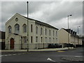
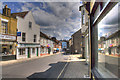
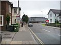
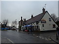
Photos of GU34 1AF


Area Information
GU34 1AF is a small, densely populated residential cluster in England, covering just 276 square metres and home to 1,547 residents. Its compact size means it is a tightly knit community, with a high population density of over 5.6 million people per square kilometre. The area is characterised by a mature demographic, with a median age of 47 and most residents falling within the 30-64 age range. This suggests a community of established professionals and families, many of whom may be renting rather than owning their homes—only 39% of properties are owner-occupied. The area’s proximity to amenities such as retail outlets, rail stations, and airports makes it convenient for those seeking accessibility to nearby towns and transport networks. However, its small footprint means it is not a sprawling suburb but a focused, localised postcode with a distinct, close-knit character. Living here involves navigating a compact environment where daily life is shaped by proximity to shops, transport hubs, and the surrounding countryside, though the high density may influence the pace of life.
- Area Type
- Postcode
- Area Size
- 276 m²
- Population
- 1547
- Population Density
- 4531 people/km²
The property market in GU34 1AF is largely rental-focused, with only 39% of homes owner-occupied. This suggests a market where flats predominate, likely catering to tenants rather than buyers seeking long-term investment. The small area size and high population density imply limited housing stock, which may drive competition among renters. For buyers, the scarcity of owner-occupied properties could make purchasing a home challenging, particularly in a small postcode where the immediate surroundings are similarly constrained. The prevalence of flats may also mean that property values are influenced by proximity to amenities and transport links, which are critical for residents in this densely populated area. Potential buyers should consider whether the rental-heavy market aligns with their goals, as opportunities for ownership may be limited compared to larger, more spread-out regions.
House Prices in GU34 1AF
No properties found in this postcode.
Energy Efficiency in GU34 1AF
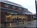
Living in GU34 1AF offers access to a range of nearby amenities within practical reach. Retail options include Iceland Alton, M&S Alton SF, and The Southern Co-operative Co, providing everyday shopping needs. The area’s rail stations—Alton and Bentley—connect residents to broader networks, while nearby airports like Lasham and RAF Odiham cater to travel requirements. A metro station at Medstead & Four Marks adds to the transport diversity. Though the area is small, these amenities contribute to a functional lifestyle, blending convenience with proximity to larger towns. The compact nature of the postcode means that daily errands and travel are efficiently managed, though the limited space may mean that leisure options are more focused on nearby towns rather than local parks or entertainment venues.
Amenities
Schools
| Rank | School | Type | Entry gender | Ages |
|---|
Explore more schools in this area
Go to Schools tabDemographics
The community in GU34 1AF is predominantly composed of adults aged 30-64, with a median age of 47, indicating a mature population. Over 39% of residents own their homes, though the majority live in flats, reflecting a rental-heavy market. The predominant ethnic group is White, which aligns with broader regional demographics. The high population density—over 5.6 million people per square kilometre—suggests a compact, possibly multi-generational living environment. This density may influence social dynamics, fostering a sense of community but also potentially straining local resources. The age profile suggests a stable, established population, though the lack of data on younger or older demographics means the area’s full generational balance remains unclear. The focus on rental properties and flats may indicate a transient or economically diverse population, with fewer long-term homeowners.
Household Size
Accommodation Type
Tenure
Ethnic Group
Religion
Household Composition
Age
Household Deprivation
NS-SEC
Explore more demographic insights in this area
Go to Demographics tabPlanning
Planning Constraints
- Flood RiskPremium
- Ramsar Wetland SitesPremium
- Area of Outstanding Natural BeautyPremium
- Protected Nature ReservePremium
- Protected WoodlandPremium
- Crime RiskPremium