Area Overview for GU33 7AE
Photos of GU33 7AE

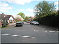
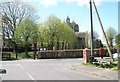
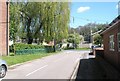
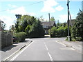
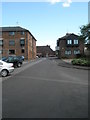
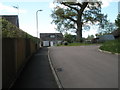
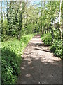
100 photos from this area
Area Information
Key information about the GU33 7AE including its size, population, and administrative classification.
- Area Type
- Postcode
- Area Size
- 21.5 hectares
- Population
- 1723
- Population Density
- 300 people/km²
House Prices in GU33 7AE
25
Properties
£316,550
Average Sold Price
£95,000
Lowest Price
£499,950
Highest Price
Showing 25 properties
| Address | Type | Beds | Baths | Last Sale Price | Last Sale Date | |
|---|---|---|---|---|---|---|
| 1 Riverside Close, Liss, GU33 7AE | Detached | 3 | - | £499,950 | Aug 2024 | |
| 9 Riverside Close, Liss, GU33 7AE | Bungalow | - | - | £375,000 | Jul 2023 | |
| 5 Riverside Close, Liss, GU33 7AE | Bungalow | - | - | £385,000 | Mar 2022 | |
| 12 Riverside Close, Liss, GU33 7AE | Bungalow | 3 | 1 | £395,000 | Jun 2021 | |
| 16A Riverside Close, Liss, GU33 7AE | Bungalow | - | - | £435,000 | Dec 2019 | |
| 2 Riverside Close, Liss, GU33 7AE | Bungalow | - | - | £362,500 | Apr 2019 | |
| 19 Riverside Close, Liss, GU33 7AE | house | - | - | £420,000 | Apr 2018 | |
| 18 Riverside Close, Liss, GU33 7AE | house | - | - | £342,000 | Jan 2018 | |
| 11 Riverside Close, Liss, GU33 7AE | Bungalow | 4 | 2 | £422,500 | Oct 2017 | |
| 15 Riverside Close, Liss, GU33 7AE | Bungalow | 2 | - | £325,000 | Dec 2015 |
Page 1 of 3
Energy Efficiency in GU33 7AE
Amenities
Schools
| Rank | School | Type | Entry gender | Ages |
|---|
Explore more schools in this area
Go to Schools tabDemographics
Household Size
Two person
most common
Accommodation Type
Houses
most common
Tenure
79
majority
Ethnic Group
White
most common
Religion
N/A
most common
Household Composition
N/A
most common
Age
47
median
Adults (30-64 years)
most common
Household Deprivation
N/A
with no deprivation
NS-SEC
44
in Lower managerial occupations
Explore more demographic insights in this area
Go to Demographics tabPlanning
Planning Constraints
- Flood RiskPremium
- Ramsar Wetland SitesPremium
- Area of Outstanding Natural BeautyPremium
- Protected Nature ReservePremium
- Protected WoodlandPremium