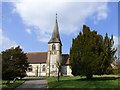
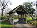
Area Overview for GU33 6YX
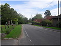
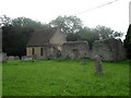
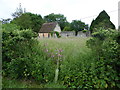
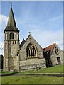
Photos of GU33 6YX


Area Information
Living in GU33 6YX means being part of a small, tightly knit residential cluster in England. With a population of 1,266 and a density of 82 people per square kilometre, this area is compact yet functional. It caters to a community of adults aged 30–64, with a median age of 47, suggesting a stable, mature demographic. The area is predominantly owner-occupied, with 80% of homes in private hands, and most properties are houses rather than flats. This reflects a quieter, more traditional residential environment. Nearby, Greatham Primary School offers a good Ofsted-rated education for younger families, while three railway stations—Liss, Liphook, and Petersfield—provide easy access to regional transport networks. The area’s low crime risk and absence of environmental constraints like protected woodlands or wetlands make it appealing for those prioritising safety and practicality. Daily life here balances proximity to essential services with a sense of seclusion, ideal for those seeking a manageable, family-friendly setting without the pressures of larger urban centres.
- Area Type
- Postcode
- Area Size
- Not available
- Population
- 1266
- Population Density
- 82 people/km²
The property market in GU33 6YX is characterised by high home ownership—80% of properties are owner-occupied—suggesting a stable, long-term resident base. The accommodation type is predominantly houses, which is typical of smaller, rural or semi-rural areas where larger homes are preferred. This contrasts with urban centres where flats dominate. The small population and low density indicate that the area is not a hotbed for speculative investment or rapid development, but rather a place where properties are likely to be family homes passed down through generations. For buyers, this means a market focused on private ownership rather than rental yields. The lack of large-scale commercial or industrial zones nearby reinforces the residential nature of the area. Prospective buyers should consider that the limited size of the postcode may mean competition for properties is low, but the surrounding areas might offer more options for those seeking a broader search.
House Prices in GU33 6YX
No properties found in this postcode.
Energy Efficiency in GU33 6YX
Residents of GU33 6YX have access to a range of local amenities within practical reach. Retail options include Tesco Liss, Tesco Bordon, and Lidl Bordon, offering grocery and household essentials. These stores provide convenience for daily shopping without the need to travel far. The area’s proximity to three railway stations—Liss, Liphook, and Petersfield—enhances mobility, allowing easy access to nearby towns for work, leisure, or socialising. While the data does not mention parks or recreational facilities, the absence of environmental constraints like protected woodlands or wetlands suggests that the area is not restricted in terms of land use, potentially leaving space for informal outdoor activities. The combination of retail, transport, and low environmental restrictions creates a lifestyle that balances practicality with a degree of flexibility for residents.
Amenities
Schools
The nearest school to GU33 6YX is Greatham Primary School, which provides education for younger children and holds a ‘good’ Ofsted rating. This rating indicates that the school meets or exceeds national standards in teaching quality, pupil outcomes, and overall performance. The presence of a primary school nearby is a key consideration for families, offering convenience for parents and a stable educational foundation for children. However, the data does not include secondary schools or further education institutions in the immediate vicinity, so families requiring comprehensive schooling may need to look beyond the area for secondary options. The availability of a well-rated primary school suggests that the community prioritises education, and the school’s performance may contribute to the area’s appeal for families.
| Rank | School | Type | Entry gender | Ages |
|---|
Explore more schools in this area
Go to Schools tabDemographics
The community in GU33 6YX is defined by its mature age profile, with a median age of 47 and the most common age range being 30–64 years. This suggests a population largely in their prime working years, with many likely to be established professionals or families. Home ownership is high, at 80%, indicating a stable, long-term resident base rather than a transient rental market. The accommodation type is predominantly houses, reflecting a preference for private, spacious living over flats. The predominant ethnic group is White, though no specific diversity statistics are provided. The low population density of 82 people per square kilometre implies a spread-out, less congested environment. This demographic profile aligns with a community focused on comfort and continuity, where most residents are likely to have built their homes over time rather than moved in recently. The absence of specific deprivation data means the area’s quality of life is inferred from its safety, infrastructure, and amenities.
Household Size
Accommodation Type
Tenure
Ethnic Group
Religion
Household Composition
Age
Household Deprivation
NS-SEC
Explore more demographic insights in this area
Go to Demographics tabPlanning
Planning Constraints
- Flood RiskPremium
- Ramsar Wetland SitesPremium
- Area of Outstanding Natural BeautyPremium
- Protected Nature ReservePremium
- Protected WoodlandPremium