Area Overview for GU32 3EX
Photos of GU32 3EX
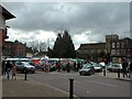
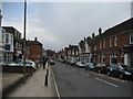
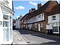
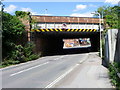
100 photos from this area
Area Information
Key information about the GU32 3EX including its size, population, and administrative classification.
- Area Type
- Postcode
- Area Size
- 9010 m²
- Population
- 1108
- Population Density
- 4626 people/km²
House Prices in GU32 3EX
40
Properties
£400,988
Average Sold Price
£72,500
Lowest Price
£895,000
Highest Price
Showing 40 properties
| Address | Type | Beds | Baths | Last Sale Price | Last Sale Date | |
|---|---|---|---|---|---|---|
| 16 Barham Road, Petersfield, GU32 3EX | Terraced | 3 | 1 | £515,000 | Sep 2023 | |
| 2 Barham Road, Petersfield, GU32 3EX | house | 4 | - | £895,000 | Oct 2021 | |
| 1C Barham Road, Petersfield, GU32 3EX | house | - | - | £590,000 | Mar 2021 | |
| 10 Barham Road, Petersfield, GU32 3EX | Terraced | 3 | 1 | £456,380 | Nov 2020 | |
| 14 Barham Road, Petersfield, GU32 3EX | Terraced | 3 | 1 | £405,000 | Nov 2018 | |
| 48 Barham Road, Petersfield, GU32 3EX | Bungalow | - | - | £399,950 | Jun 2018 | |
| 24 Barham Road, Petersfield, GU32 3EX | Terraced | 3 | 2 | £370,000 | May 2017 | |
| 46 Barham Road, Petersfield, GU32 3EX | Semi-detached | - | - | £400,000 | Oct 2016 | |
| 26 Barham Road, Petersfield, GU32 3EX | house | - | - | £350,000 | Mar 2014 | |
| 20 Barham Road, Petersfield, GU32 3EX | house | - | - | £255,000 | Sep 2012 |
Page 1 of 4
Energy Efficiency in GU32 3EX
Amenities
Schools
| Rank | School | Type | Entry gender | Ages |
|---|
Explore more schools in this area
Go to Schools tabDemographics
Household Size
One person
most common
Accommodation Type
Flats
most common
Tenure
55
majority
Ethnic Group
White
most common
Religion
N/A
most common
Household Composition
N/A
most common
Age
47
median
Adults (30-64 years)
most common
Household Deprivation
N/A
with no deprivation
NS-SEC
46
in Lower managerial occupations
Explore more demographic insights in this area
Go to Demographics tabPlanning
Planning Constraints
- Flood RiskPremium
- Ramsar Wetland SitesPremium
- Area of Outstanding Natural BeautyPremium
- Protected Nature ReservePremium
- Protected WoodlandPremium