Area Overview for GU32 3AS
Photos of GU32 3AS
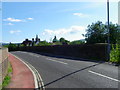
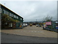
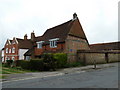
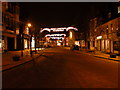
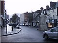
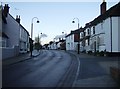
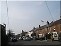
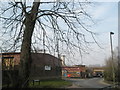
100 photos from this area
Area Information
Key information about the GU32 3AS including its size, population, and administrative classification.
- Area Type
- Postcode
- Area Size
- 5782 m²
- Population
- 1196
- Population Density
- 2360 people/km²
House Prices in GU32 3AS
14
Properties
£235,475
Average Sold Price
£44,800
Lowest Price
£417,500
Highest Price
Showing 14 properties
| Address | Type | Beds | Baths | Last Sale Price | Last Sale Date | |
|---|---|---|---|---|---|---|
| 96 Rushes Road, Petersfield, GU32 3AS | Semi-detached | 2 | 1 | £310,750 | Nov 2023 | |
| 108 Rushes Road, Petersfield, GU32 3AS | Terraced | 2 | 1 | £410,000 | Jul 2021 | |
| 110 Rushes Road, Petersfield, GU32 3AS | house | - | - | £417,500 | May 2021 | |
| 104 Rushes Road, Petersfield, GU32 3AS | Terraced | 3 | 1 | £317,000 | Jul 2019 | |
| 106 Rushes Road, Petersfield, GU32 3AS | house | 2 | - | £360,000 | Jan 2018 | |
| 114 Rushes Road, Petersfield, GU32 3AS | house | - | - | £210,000 | Jan 2011 | |
| 90 Rushes Road, Petersfield, GU32 3AS | Terraced | 4 | 1 | £162,500 | Sep 2002 | |
| 102 Rushes Road, Petersfield, GU32 3AS | Terraced | - | - | £52,250 | Jun 1997 | |
| 98 Rushes Road, Petersfield, GU32 3AS | house | 2 | - | £44,800 | Jan 1997 | |
| 100 Rushes Road, Petersfield, GU32 3AS | Terraced | - | - | £69,950 | Oct 1996 |
Page 1 of 2
Energy Efficiency in GU32 3AS
Amenities
Schools
| Rank | School | Type | Entry gender | Ages |
|---|
Explore more schools in this area
Go to Schools tabDemographics
Household Size
Family (3-5 people)
most common
Accommodation Type
Houses
most common
Tenure
68
majority
Ethnic Group
White
most common
Religion
N/A
most common
Household Composition
N/A
most common
Age
47
median
Adults (30-64 years)
most common
Household Deprivation
N/A
with no deprivation
NS-SEC
37
in Lower managerial occupations
Explore more demographic insights in this area
Go to Demographics tabPlanning
Planning Constraints
- Flood RiskPremium
- Ramsar Wetland SitesPremium
- Area of Outstanding Natural BeautyPremium
- Protected Nature ReservePremium
- Protected WoodlandPremium