Area Overview for GU32 2EB
Photos of GU32 2EB
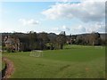
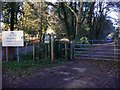
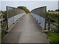
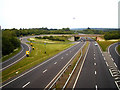
100 photos from this area
Area Information
Key information about the GU32 2EB including its size, population, and administrative classification.
- Area Type
- Postcode
- Area Size
- 2.9 hectares
- Population
- 1209
- Population Density
- 1435 people/km²
House Prices in GU32 2EB
26
Properties
£664,500
Average Sold Price
£149,205
Lowest Price
£1,062,300
Highest Price
Showing 26 properties
| Address | Type | Beds | Baths | Last Sale Price | Last Sale Date | |
|---|---|---|---|---|---|---|
| 54 Woodbury Avenue, Petersfield, GU32 2EB | Detached | 4 | 2 | £942,500 | Jan 2024 | |
| 71 Woodbury Avenue, Petersfield, GU32 2EB | Detached | 4 | 2 | £1,062,300 | Oct 2021 | |
| 63 Woodbury Avenue, Petersfield, GU32 2EB | Detached | 4 | - | £1,026,000 | Feb 2021 | |
| 81 Woodbury Avenue, Petersfield, GU32 2EB | Detached | 4 | 3 | £1,000,000 | Aug 2018 | |
| 79A Woodbury Avenue, Petersfield, GU32 2EB | Bungalow | - | - | £720,000 | Jun 2017 | |
| 73A Woodbury Avenue, Petersfield, GU32 2EB | house | - | - | £655,000 | Sep 2016 | |
| 65 Woodbury Avenue, Petersfield, GU32 2EB | house | - | - | £700,000 | Aug 2016 | |
| 58 Woodbury Avenue, Petersfield, GU32 2EB | Detached | - | - | £625,000 | Sep 2012 | |
| 46 Woodbury Avenue, Petersfield, GU32 2EB | Detached | - | - | £575,000 | Aug 2007 | |
| 67 Woodbury Avenue, Petersfield, GU32 2EB | Detached | 3 | 2 | £483,500 | May 2005 |
Page 1 of 3
Energy Efficiency in GU32 2EB
Amenities
Schools
| Rank | School | Type | Entry gender | Ages |
|---|
Explore more schools in this area
Go to Schools tabDemographics
Household Size
Two person
most common
Accommodation Type
Houses
most common
Tenure
79
majority
Ethnic Group
White
most common
Religion
N/A
most common
Household Composition
N/A
most common
Age
47
median
Adults (30-64 years)
most common
Household Deprivation
N/A
with no deprivation
NS-SEC
48
in Lower managerial occupations
Explore more demographic insights in this area
Go to Demographics tabPlanning
Planning Constraints
- Flood RiskPremium
- Ramsar Wetland SitesPremium
- Area of Outstanding Natural BeautyPremium
- Protected Nature ReservePremium
- Protected WoodlandPremium