Area Overview for GU32 2BP
Photos of GU32 2BP
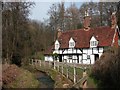
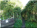
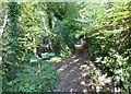
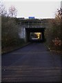
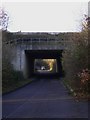
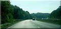
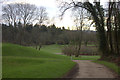
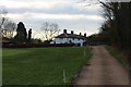
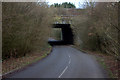
66 photos from this area
Area Information
Key information about the GU32 2BP including its size, population, and administrative classification.
- Area Type
- Postcode
- Area Size
- 19.8 hectares
- Population
- 2901
- Population Density
- 57 people/km²
House Prices in GU32 2BP
12
Properties
£1,104,648
Average Sold Price
£810,000
Lowest Price
£1,323,945
Highest Price
Showing 12 properties
| Address | Type | Beds | Baths | Last Sale Price | Last Sale Date | |
|---|---|---|---|---|---|---|
| Home Cottage, Elmwood Lane, Steep Marsh, Petersfield, GU32 2BP | house | 2 | - | £1,323,945 | Dec 2021 | |
| Tower Cottage, Elmwood Lane, Steep Marsh, Petersfield, GU32 2BP | house | 5 | - | £1,180,000 | Aug 2018 | |
| Venables House, Elmwood Lane, Steep Marsh, Petersfield, GU32 2BP | Detached | 4 | - | £810,000 | Oct 2014 | |
| Richards Photoprint, Elmwood House, Elmwood Lane, Steep Marsh, Petersfield, GU32 2BP | Detached | 4 | - | - | - | |
| Annexe, Downgate Farm, Elmwood Lane, Steep Marsh, Petersfield, GU32 2BP | Cottage | 1 | 1 | - | - | |
| Natterjacks, Elmwood Lane, Steep Marsh, Petersfield, GU32 2BP | Detached | - | - | - | - | |
| Downgate Farm, Elmwood Lane, Steep Marsh, Petersfield, GU32 2BP | house | - | - | - | - | |
| Kettlebrook Springs, Elmwood Lane, Steep Marsh, Petersfield, GU32 2BP | Detached | - | - | - | - | |
| Tennis 53M From Natterjacks 38M From Unnamed Road, Elmwood Lane, Steep Marsh, Petersfield, GU32 2BP | Leisure | - | - | - | - | |
| Tennis 53M From Tower Cottage 31M From Unnamed Road, Steep Marsh Lane, Steep, Petersfield, GU32 2BP | Leisure | - | - | - | - |
Page 1 of 2
Energy Efficiency in GU32 2BP
Amenities
Schools
| Rank | School | Type | Entry gender | Ages |
|---|
Explore more schools in this area
Go to Schools tabDemographics
Household Size
Family (3-5 people)
most common
Accommodation Type
Houses
most common
Tenure
69
majority
Ethnic Group
White
most common
Religion
N/A
most common
Household Composition
N/A
most common
Age
47
median
Adults (30-64 years)
most common
Household Deprivation
N/A
with no deprivation
NS-SEC
44
in Lower managerial occupations
Explore more demographic insights in this area
Go to Demographics tabPlanning
Planning Constraints
- Flood RiskPremium
- Ramsar Wetland SitesPremium
- Area of Outstanding Natural BeautyPremium
- Protected Nature ReservePremium
- Protected WoodlandPremium