Area Overview for GU31 5WB
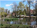
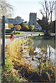
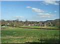
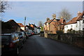
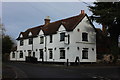
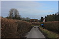
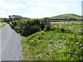
Photos of GU31 5WB


Area Information
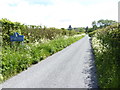
GU31 5WB is a small, residential postcode area in England, home to 2264 people spread across a low-density landscape of 35 people per square kilometre. This suggests a quiet, spaced-out community where homes are likely set in larger plots. The area’s character is defined by its modest size and the presence of established housing stock, which caters to a population with a median age of 47. Most residents fall within the 30–64 age range, indicating a stable demographic of working-age adults and families. Living here means proximity to local amenities such as schools, rail links, and retail hubs in nearby towns like Petersfield. The area’s small footprint means it’s likely nestled within a broader rural or semi-rural setting, offering a balance of seclusion and access to services. For those seeking a peaceful, low-density environment without sacrificing connectivity, GU31 5WB provides a foundation of safety, with low crime risk and no environmental constraints like flood zones or protected land. This makes it an appealing choice for those prioritising stability and a slower pace of life.
- Area Type
- Postcode
- Area Size
- Not available
- Population
- 2264
- Population Density
- 35 people/km²
The property market in GU31 5WB is characterised by a high rate of home ownership (68%), with houses forming the primary accommodation type. This suggests a market skewed towards owner-occupied properties rather than rentals, which may reflect the area’s appeal to families and long-term residents. The low population density and focus on houses imply that the housing stock is likely older and more spread out, with limited high-density development. For buyers, this means a smaller selection of properties within the immediate postcode, but proximity to nearby towns like Petersfield may offer additional options. The predominance of houses could also indicate a demand for family homes, which may influence property values and availability. Given the area’s small size, buyers should consider surrounding regions for a broader range of properties. The high home ownership rate also suggests a stable market with fewer speculative investments, potentially offering long-term security for residents.
House Prices in GU31 5WB
No properties found in this postcode.
Energy Efficiency in GU31 5WB
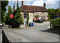
The lifestyle in GU31 5WB is shaped by its proximity to nearby amenities, including retail hubs and rail links. Within practical reach are notable shops such as Tesco Petersfield, M&S Petersfield SF, and Cook Petersfield, offering a range of shopping and dining options. These venues cater to everyday needs, from groceries to clothing, reducing the necessity for long trips to larger centres. The area’s rail network, with stations at Petersfield and Liss, enhances mobility, allowing residents to access broader services in surrounding towns. While the data does not specify parks or leisure facilities, the absence of environmental constraints like protected woodlands or AONB areas suggests that the landscape is likely accessible for outdoor activities. The combination of retail, rail, and low environmental restrictions creates a convenient yet low-key lifestyle, ideal for those seeking a balance between local convenience and a quieter environment.
Amenities
Schools
Residents of GU31 5WB have access to a mix of primary schools, including Buriton Primary School and East Meon Church of England Controlled Primary School, both of which hold a ‘good’ Ofsted rating. These state-funded schools provide a reliable educational foundation for younger children. For those seeking independent education, Ditcham Park School is available, though its specific rating is not provided. The presence of both state and independent options offers families flexibility in choosing their child’s schooling. The ‘good’ ratings at the primary schools indicate a standard of education that meets or exceeds national benchmarks, which is a key consideration for families prioritising academic quality. The proximity of these schools to the area suggests that parents can easily access them, reducing the need for long commutes. However, the absence of secondary schools in the immediate vicinity may require families to look further afield for comprehensive education.
| Rank | School | Type | Entry gender | Ages |
|---|
Explore more schools in this area
Go to Schools tabDemographics
The community in GU31 5WB is predominantly composed of adults aged 30–64, with a median age of 47. This suggests a mature, established population, likely with long-term ties to the area. Home ownership is high at 68%, indicating a strong presence of owner-occupied properties. The accommodation type is primarily houses, which aligns with the low population density and the typical layout of such postcode areas. The predominant ethnic group is White, though the data does not specify further diversity metrics. The absence of detailed information on deprivation or income levels means the quality of life can only be inferred from available indicators, such as safety and access to services. The age profile and home ownership rates suggest a community that is largely self-sufficient, with a focus on long-term residency rather than transient populations. This stability may contribute to a cohesive local environment, though the data does not quantify social cohesion or community engagement.
Household Size
Accommodation Type
Tenure
Ethnic Group
Religion
Household Composition
Age
Household Deprivation
NS-SEC
Explore more demographic insights in this area
Go to Demographics tabPlanning
Planning Constraints
- Flood RiskPremium
- Ramsar Wetland SitesPremium
- Area of Outstanding Natural BeautyPremium
- Protected Nature ReservePremium
- Protected WoodlandPremium