Area Overview for GU31 5BN
Photos of GU31 5BN


Area Information
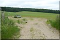
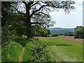
GU31 5BN is a small, tightly knit residential cluster in England, spanning 25.3 hectares and home to 1,338 residents. With a population density of 66 people per square kilometre, the area feels quiet and unassuming, offering a low-key alternative to busier towns. Daily life here is shaped by its modest size and the presence of nearby amenities. The community is predominantly middle-aged, with a median age of 47 and a strong concentration of adults aged 30–64. Most residents own their homes, with 70% of properties in private ownership, and the housing stock is largely composed of houses rather than flats. The area’s appeal lies in its simplicity: no major urban pressures, limited environmental constraints, and a straightforward lifestyle. While it lacks the cultural vibrancy of larger towns, its proximity to rail stations and basic retail options makes it practical for those prioritising convenience over cosmopolitan amenities.
- Area Type
- Postcode
- Area Size
- 25.3 hectares
- Population
- 1338
- Population Density
- 66 people/km²
The property market in GU31 5BN is characterised by a high rate of home ownership, with 70% of properties owned by residents rather than rented. This suggests a community of long-term residents who have invested in their homes, which may stabilise the local market. The accommodation type is almost exclusively houses, which contrasts with areas dominated by flats or apartments. Given the small size of the area—just 25.3 hectares—and the limited number of properties, the housing stock is likely constrained, making it a niche market for buyers seeking a quiet, low-density environment. The predominance of owner-occupied homes may also indicate limited rental availability, which could be a consideration for those exploring investment opportunities. Buyers should focus on proximity to nearby amenities, such as rail stations and retail outlets, as the area’s immediate surroundings offer practical connectivity despite its modest scale.
House Prices in GU31 5BN
Showing 7 properties
| Address | Type | Beds | Baths | Last Sale Price | Last Sale Date | |
|---|---|---|---|---|---|---|
| Little Slade, Slade Lane, Rogate, GU31 5BN | Detached | 4 | 3 | £1,350,000 | Nov 2020 | |
| Old Heartwood, Slade Lane, Rogate, GU31 5BN | Semi-detached | 4 | - | £950,000 | Nov 2013 | |
| Slade House, Slade Lane, Rogate, GU31 5BN | Bungalow | - | - | £218,500 | Feb 2001 | |
| Walnut Tree Barn, Slade Lane, Rogate, GU31 5BN | house | 3 | - | - | - | |
| Slade Farm House, Slade Lane, Rogate, GU31 5BN | Detached | - | - | - | - | |
| Slade Farm, Slade Lane, Rogate, GU31 5BN | Farm | - | - | - | - | |
| Hedge Lee, Slade Lane, Rogate, GU31 5BN | Detached | - | - | - | - |
Energy Efficiency in GU31 5BN
The lifestyle in GU31 5BN is shaped by its proximity to basic retail and rail services. Nearby shops include Tesco Liss, The Southern Co-operative Co, and Asda Ramshill, offering essential grocery and retail options within practical reach. These stores cater to daily needs, reducing the necessity for long trips to larger towns. The area’s rail stations—Liss, Petersfield, and Liphook—provide access to broader networks, enabling travel to nearby cities or towns for work, leisure, or socialising. While the data does not mention parks or leisure facilities, the absence of environmental constraints like protected woodlands or AONBs suggests open spaces may be available. The combination of retail convenience and rail connectivity supports a straightforward, practical lifestyle, ideal for those prioritising accessibility over extensive recreational amenities.
Amenities
Schools
The nearest school to GU31 5BN is Rogate CofE Primary School, which serves the local community with a primary education offering. Its Ofsted rating of ‘good’ reflects a satisfactory standard of teaching and facilities, though no secondary schools are listed in the data. The presence of a primary school is a key factor for families, as it provides immediate access to early education without the need for long commutes. However, the absence of secondary school options within the area may require families to look further afield for secondary education. The single school listed suggests a modest educational landscape, which could be a consideration for parents prioritising a range of school choices.
| Rank | School | Type | Entry gender | Ages |
|---|
Explore more schools in this area
Go to Schools tabDemographics
The community in GU31 5BN is defined by its age profile and home ownership rates. With a median age of 47, the area is dominated by adults in their 30s to 60s, suggesting a stable population with long-term residency. The most common age range, 30–64 years, aligns with a demographic that typically prioritises family homes and local amenities. Home ownership is high, at 70%, indicating a community of established residents rather than transient renters. The accommodation type is predominantly houses, which may reflect the area’s rural or semi-rural character. Ethnically, the population is largely White, though no specific data on diversity or deprivation is provided. The low population density of 66 people per square kilometre suggests a spread-out, possibly suburban layout, which may influence the social dynamics and pace of life in the area.
Household Size
Accommodation Type
Tenure
Ethnic Group
Religion
Household Composition
Age
Household Deprivation
NS-SEC
Explore more demographic insights in this area
Go to Demographics tabPlanning
Planning Constraints
- Flood RiskPremium
- Ramsar Wetland SitesPremium
- Area of Outstanding Natural BeautyPremium
- Protected Nature ReservePremium
- Protected WoodlandPremium