Area Overview for GU31 4ES
Photos of GU31 4ES
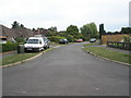
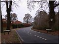
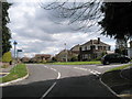
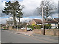
100 photos from this area
Area Information
Key information about the GU31 4ES including its size, population, and administrative classification.
- Area Type
- Postcode
- Area Size
- 8019 m²
- Population
- 2257
- Population Density
- 924 people/km²
House Prices in GU31 4ES
13
Properties
£325,000
Average Sold Price
£138,000
Lowest Price
£550,000
Highest Price
Showing 13 properties
| Address | Type | Beds | Baths | Last Sale Price | Last Sale Date | |
|---|---|---|---|---|---|---|
| 2 Eastlake Close, Petersfield, GU31 4ES | Semi-detached | 3 | 2 | £485,000 | Nov 2022 | |
| 6 Eastlake Close, Petersfield, GU31 4ES | Bungalow | 4 | 2 | £550,000 | Jun 2022 | |
| 9 Eastlake Close, Petersfield, GU31 4ES | Bungalow | 4 | - | £420,000 | Apr 2015 | |
| 11 Eastlake Close, Petersfield, GU31 4ES | Bungalow | 2 | - | £260,000 | Oct 2010 | |
| 13 Eastlake Close, Petersfield, GU31 4ES | Bungalow | - | - | £210,000 | Jul 2009 | |
| 10 Eastlake Close, Petersfield, GU31 4ES | Terraced | - | - | £270,000 | Feb 2006 | |
| 8 Eastlake Close, Petersfield, GU31 4ES | Semi-detached | - | - | £267,000 | Dec 2004 | |
| 7 Eastlake Close, Petersfield, GU31 4ES | Semi-detached | - | - | £138,000 | Jun 2000 | |
| 12 Eastlake Close, Petersfield, GU31 4ES | Semi-detached | - | - | - | - | |
| 1 Eastlake Close, Petersfield, GU31 4ES | Semi-detached | - | - | - | - |
Page 1 of 2
Energy Efficiency in GU31 4ES
Amenities
Schools
| Rank | School | Type | Entry gender | Ages |
|---|
Explore more schools in this area
Go to Schools tabDemographics
Household Size
Family (3-5 people)
most common
Accommodation Type
Houses
most common
Tenure
68
majority
Ethnic Group
White
most common
Religion
N/A
most common
Household Composition
N/A
most common
Age
47
median
Adults (30-64 years)
most common
Household Deprivation
N/A
with no deprivation
NS-SEC
38
in Lower managerial occupations
Explore more demographic insights in this area
Go to Demographics tabPlanning
Planning Constraints
- Flood RiskPremium
- Ramsar Wetland SitesPremium
- Area of Outstanding Natural BeautyPremium
- Protected Nature ReservePremium
- Protected WoodlandPremium