Area Overview for GU30 7QZ
Photos of GU30 7QZ

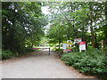
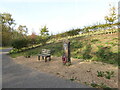
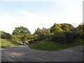
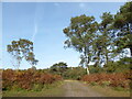
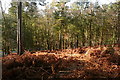
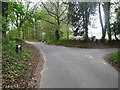
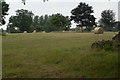
25 photos from this area
Area Information
Key information about the GU30 7QZ including its size, population, and administrative classification.
- Area Type
- Postcode
- Area Size
- 1.4 km²
- Population
- 1904
- Population Density
- 257 people/km²
House Prices in GU30 7QZ
29
Properties
£1,007,455
Average Sold Price
£125,000
Lowest Price
£3,090,000
Highest Price
Showing 29 properties
| Address | Type | Beds | Baths | Last Sale Price | Last Sale Date | |
|---|---|---|---|---|---|---|
| Mulberry House, Rectory Lane, Bramshott, Liphook, GU30 7QZ | Detached | 5 | 4 | £3,090,000 | Mar 2025 | |
| The Freckling, Rectory Lane, Bramshott, Liphook, GU30 7QZ | Bungalow | - | - | £810,000 | Jun 2021 | |
| Greenways, Rectory Lane, Bramshott, Liphook, GU30 7QZ | house | - | - | £1,180,000 | Aug 2016 | |
| Outwoods, Rectory Lane, Bramshott, Liphook, GU30 7QZ | Detached | 6 | 3 | £1,525,000 | Apr 2013 | |
| Bramshott Thatch, Rectory Lane, Bramshott, Liphook, GU30 7QZ | house | 6 | - | £1,850,000 | Nov 2010 | |
| 2, Reedens Bungalows, Rectory Lane, Bramshott, Liphook, GU30 7QZ | Equestrian | 3 | 2 | £399,550 | Jul 2003 | |
| Clarksfield, Rectory Lane, Bramshott, Liphook, GU30 7QZ | Detached | 4 | 4 | £225,000 | Aug 1998 | |
| Feathers, Rectory Lane, Bramshott, Liphook, GU30 7QZ | Bungalow | 2 | 1 | £687,500 | May 1998 | |
| Chinthay Cottage, Rectory Lane, Bramshott, Liphook, GU30 7QZ | Detached | - | - | £182,500 | Jul 1996 | |
| 1, Reedens Bungalows, Rectory Lane, Bramshott, Liphook, GU30 7QZ | Flat | - | - | £125,000 | Sep 1995 |
Page 1 of 3
Energy Efficiency in GU30 7QZ
Amenities
Schools
| Rank | School | Type | Entry gender | Ages |
|---|
Explore more schools in this area
Go to Schools tabDemographics
Household Size
Two person
most common
Accommodation Type
Houses
most common
Tenure
90
majority
Ethnic Group
White
most common
Religion
N/A
most common
Household Composition
N/A
most common
Age
47
median
Adults (30-64 years)
most common
Household Deprivation
N/A
with no deprivation
NS-SEC
48
in Lower managerial occupations
Explore more demographic insights in this area
Go to Demographics tabPlanning
Planning Constraints
- Flood RiskPremium
- Ramsar Wetland SitesPremium
- Area of Outstanding Natural BeautyPremium
- Protected Nature ReservePremium
- Protected WoodlandPremium