Area Overview for GU30 7QJ
Photos of GU30 7QJ
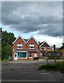
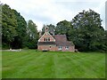
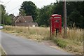
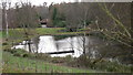
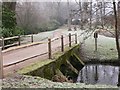
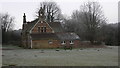

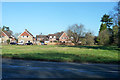
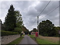
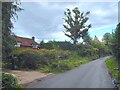
43 photos from this area
Area Information
Key information about the GU30 7QJ including its size, population, and administrative classification.
- Area Type
- Postcode
- Area Size
- 22.7 hectares
- Population
- 2094
- Population Density
- 132 people/km²
House Prices in GU30 7QJ
18
Properties
£831,143
Average Sold Price
£130,000
Lowest Price
£1,475,000
Highest Price
Showing 18 properties
| Address | Type | Beds | Baths | Last Sale Price | Last Sale Date | |
|---|---|---|---|---|---|---|
| Old Post Cottage, Conford Road, Conford, Liphook, GU30 7QJ | house | 4 | 2 | £1,200,000 | Aug 2024 | |
| Naham, Conford Road, Conford, Liphook, GU30 7QJ | house | - | - | £812,500 | Oct 2022 | |
| Yewcroft, Conford Road, Conford, Liphook, GU30 7QJ | house | - | - | £1,400,000 | Apr 2022 | |
| Conford Park Barn, Conford Road, Conford, Liphook, GU30 7QJ | house | - | - | £1,475,000 | Jan 2017 | |
| Woolmer, Conford Road, Conford, Liphook, GU30 7QJ | Land | - | - | £440,000 | Nov 2008 | |
| 2, Beechtree Cottages, Conford Road, Conford, Liphook, GU30 7QJ | Semi-detached | - | - | £360,500 | Oct 2008 | |
| 1, Beechtree Cottages, Conford Road, Conford, Liphook, GU30 7QJ | Semi-detached | - | - | £130,000 | Jun 1999 | |
| Green View, Conford Road, Conford, Liphook, GU30 7QJ | Detached | 4 | 2 | - | - | |
| Conford Park Hatch, Conford Road, Conford, Liphook, GU30 7QJ | Detached | 4 | 3 | - | - | |
| Thorn Cottage, Conford Road, Conford, Liphook, GU30 7QJ | Detached | 4 | 3 | - | - |
Page 1 of 2
Energy Efficiency in GU30 7QJ
Amenities
Schools
| Rank | School | Type | Entry gender | Ages |
|---|
Explore more schools in this area
Go to Schools tabDemographics
Household Size
Family (3-5 people)
most common
Accommodation Type
Houses
most common
Tenure
85
majority
Ethnic Group
White
most common
Religion
N/A
most common
Household Composition
N/A
most common
Age
47
median
Adults (30-64 years)
most common
Household Deprivation
N/A
with no deprivation
NS-SEC
49
in Lower managerial occupations
Explore more demographic insights in this area
Go to Demographics tabPlanning
Planning Constraints
- Flood RiskPremium
- Ramsar Wetland SitesPremium
- Area of Outstanding Natural BeautyPremium
- Protected Nature ReservePremium
- Protected WoodlandPremium