Area Overview for GU30 7HG
Photos of GU30 7HG
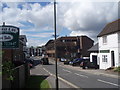
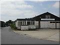
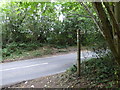
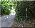
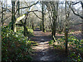
91 photos from this area
Area Information
Key information about the GU30 7HG including its size, population, and administrative classification.
- Area Type
- Postcode
- Area Size
- 2.3 hectares
- Population
- 1834
- Population Density
- 1407 people/km²
House Prices in GU30 7HG
15
Properties
£641,071
Average Sold Price
£172,000
Lowest Price
£1,064,000
Highest Price
Showing 15 properties
| Address | Type | Beds | Baths | Last Sale Price | Last Sale Date | |
|---|---|---|---|---|---|---|
| 46 Chiltley Way, Liphook, GU30 7HG | Detached | 4 | 2 | £890,000 | Jun 2025 | |
| 35 Chiltley Way, Liphook, GU30 7HG | Detached | 4 | 2 | £1,064,000 | Sep 2022 | |
| 37 Chiltley Way, Liphook, GU30 7HG | Retail | 3 | 1 | £830,000 | Jan 2022 | |
| 48 Chiltley Way, Liphook, GU30 7HG | house | - | - | £895,000 | Oct 2020 | |
| Janderell, 40 Chiltley Way, Liphook, GU30 7HG | Bungalow | - | - | £670,000 | Jul 2018 | |
| 43 Chiltley Way, Liphook, GU30 7HG | Bungalow | 4 | 3 | £815,000 | Mar 2018 | |
| 50 Chiltley Way, Liphook, GU30 7HG | Detached | 6 | 2 | £880,000 | Nov 2017 | |
| 34 Chiltley Way, Liphook, GU30 7HG | Detached | 4 | - | £670,000 | May 2014 | |
| 47 Chiltley Way, Liphook, GU30 7HG | Detached | 3 | 1 | £445,000 | Sep 2013 | |
| 49 Chiltley Way, Liphook, GU30 7HG | Bungalow | 3 | - | £420,000 | Jun 2012 |
Page 1 of 2
Energy Efficiency in GU30 7HG
Amenities
Schools
| Rank | School | Type | Entry gender | Ages |
|---|
Explore more schools in this area
Go to Schools tabDemographics
Household Size
Family (3-5 people)
most common
Accommodation Type
Houses
most common
Tenure
72
majority
Ethnic Group
White
most common
Religion
N/A
most common
Household Composition
N/A
most common
Age
47
median
Adults (30-64 years)
most common
Household Deprivation
N/A
with no deprivation
NS-SEC
43
in Lower managerial occupations
Explore more demographic insights in this area
Go to Demographics tabPlanning
Planning Constraints
- Flood RiskPremium
- Ramsar Wetland SitesPremium
- Area of Outstanding Natural BeautyPremium
- Protected Nature ReservePremium
- Protected WoodlandPremium