Area Overview for GU30 7BX
Photos of GU30 7BX

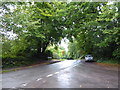
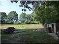
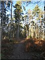

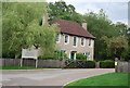
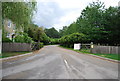
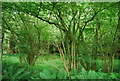
42 photos from this area
Area Information
Key information about the GU30 7BX including its size, population, and administrative classification.
- Area Type
- Postcode
- Area Size
- 3.0 hectares
- Population
- 1834
- Population Density
- 1407 people/km²
House Prices in GU30 7BX
16
Properties
£353,707
Average Sold Price
£110,000
Lowest Price
£590,000
Highest Price
Showing 16 properties
| Address | Type | Beds | Baths | Last Sale Price | Last Sale Date | |
|---|---|---|---|---|---|---|
| 143 Haslemere Road, Liphook, GU30 7BX | house | - | - | £590,000 | Apr 2021 | |
| 139 Haslemere Road, Liphook, GU30 7BX | house | - | - | £475,000 | Nov 2014 | |
| 134A Haslemere Road, Liphook, GU30 7BX | Detached | - | - | £368,000 | May 2008 | |
| 128 Haslemere Road, Liphook, GU30 7BX | Detached | 3 | 2 | £460,000 | Nov 2007 | |
| 135 Haslemere Road, Liphook, GU30 7BX | Detached | - | - | £303,000 | Jul 2004 | |
| 129 Haslemere Road, Liphook, GU30 7BX | Detached | - | - | £169,950 | May 1998 | |
| 136 Haslemere Road, Liphook, GU30 7BX | Detached | - | - | £110,000 | Jul 1995 | |
| 127 Haslemere Road, Liphook, GU30 7BX | Detached | 4 | 2 | - | - | |
| 131 Haslemere Road, Liphook, GU30 7BX | Detached | - | - | - | - | |
| 132 Haslemere Road, Liphook, GU30 7BX | Detached | - | - | - | - |
Page 1 of 2
Energy Efficiency in GU30 7BX
Amenities
Schools
| Rank | School | Type | Entry gender | Ages |
|---|
Explore more schools in this area
Go to Schools tabDemographics
Household Size
Family (3-5 people)
most common
Accommodation Type
Houses
most common
Tenure
72
majority
Ethnic Group
White
most common
Religion
N/A
most common
Household Composition
N/A
most common
Age
47
median
Adults (30-64 years)
most common
Household Deprivation
N/A
with no deprivation
NS-SEC
43
in Lower managerial occupations
Explore more demographic insights in this area
Go to Demographics tabPlanning
Planning Constraints
- Flood RiskPremium
- Ramsar Wetland SitesPremium
- Area of Outstanding Natural BeautyPremium
- Protected Nature ReservePremium
- Protected WoodlandPremium