Area Overview for GU30 7AH
Photos of GU30 7AH
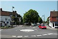
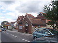

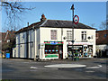
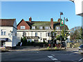
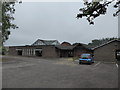
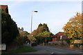
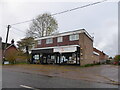
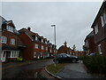

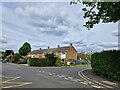
75 photos from this area
Area Information
Key information about the GU30 7AH including its size, population, and administrative classification.
- Area Type
- Postcode
- Area Size
- 5464 m²
- Population
- 2107
- Population Density
- 2124 people/km²
House Prices in GU30 7AH
19
Properties
£210,000
Average Sold Price
£150,000
Lowest Price
£267,000
Highest Price
Showing 19 properties
| Address | Type | Beds | Baths | Last Sale Price | Last Sale Date | |
|---|---|---|---|---|---|---|
| 22A The Square, Liphook, GU30 7AH | Flat | 2 | 1 | £213,000 | Dec 2023 | |
| 28, The Square, London Road, Liphook, GU30 7AH | Flat | - | - | £150,000 | Jul 2020 | |
| Flat 8 The Square, Haslemere Road, Liphook, GU30 7AH | Detached | 3 | 2 | £267,000 | May 2004 | |
| 18A The Square, Portsmouth Road, Liphook, GU30 7AH | Maisonette | 4 | 3 | - | - | |
| 14, The Square, London Road, Liphook, GU30 7AH | Flat | 2 | 1 | - | - | |
| Flat 2 Liphook Garage The Square, Haslemere Road, Liphook, GU30 7AH | Flat | 2 | 1 | - | - | |
| Flat 1 Liphook Garage The Square, Haslemere Road, Liphook, GU30 7AH | Flat | 1 | 1 | - | - | |
| The Tap House, 8 The Square, Liphook, GU30 7AH | house | - | - | - | - | |
| Living Room Cinema, Former Site Of, 2-4 The Square, Liphook, GU30 7AH | office_workshop | - | - | - | - | |
| Liphook Mobility, 14A, The Square, London Road, Liphook, GU30 7AH | shop | - | - | - | - |
Page 1 of 2
Energy Efficiency in GU30 7AH
Amenities
Schools
| Rank | School | Type | Entry gender | Ages |
|---|
Explore more schools in this area
Go to Schools tabDemographics
Household Size
Family (3-5 people)
most common
Accommodation Type
Houses
most common
Tenure
75
majority
Ethnic Group
White
most common
Religion
N/A
most common
Household Composition
N/A
most common
Age
47
median
Adults (30-64 years)
most common
Household Deprivation
N/A
with no deprivation
NS-SEC
42
in Lower managerial occupations
Explore more demographic insights in this area
Go to Demographics tabPlanning
Planning Constraints
- Flood RiskPremium
- Ramsar Wetland SitesPremium
- Area of Outstanding Natural BeautyPremium
- Protected Nature ReservePremium
- Protected WoodlandPremium