Area Overview for GU3 2EH
Photos of GU3 2EH
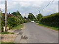
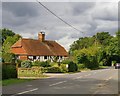

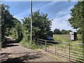
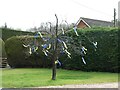
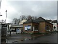
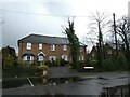
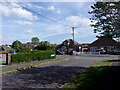
65 photos from this area
Area Information
Key information about the GU3 2EH including its size, population, and administrative classification.
- Area Type
- Postcode
- Area Size
- 1.7 hectares
- Population
- 1618
- Population Density
- 151 people/km²
House Prices in GU3 2EH
18
Properties
£484,538
Average Sold Price
£165,000
Lowest Price
£890,000
Highest Price
Showing 18 properties
| Address | Type | Beds | Baths | Last Sale Price | Last Sale Date | |
|---|---|---|---|---|---|---|
| Dormer Cottage, 175 Glaziers Lane, Normandy, GU3 2EH | house | 3 | 2 | £890,000 | Dec 2022 | |
| Thorn Cottage, 169 Glaziers Lane, Normandy, GU3 2EH | Semi-detached | 3 | 2 | £595,000 | Aug 2019 | |
| Martindale, 167 Glaziers Lane, Normandy, GU3 2EH | Detached | 5 | 2 | £650,000 | May 2017 | |
| Haytors, 208 Glaziers Lane, Normandy, GU3 2EH | Detached | 3 | 1 | £420,000 | Jun 2015 | |
| Oak Tree House, 216 Glaziers Lane, Normandy, GU3 2EH | Detached | 5 | 2 | £686,000 | Jan 2015 | |
| Little Dene, 206 Glaziers Lane, Normandy, GU3 2EH | Bungalow | 2 | - | £380,000 | Sep 2011 | |
| The Old Corner Cottage, 224 Glaziers Lane, Normandy, GU3 2EH | Detached | - | - | £320,000 | Aug 2009 | |
| Justins, 220 Glaziers Lane, Normandy, GU3 2EH | house | - | - | £535,000 | Apr 2009 | |
| December House, 218 Glaziers Lane, Normandy, GU3 2EH | Detached | - | - | £550,000 | Jan 2007 | |
| Glenmore, 173 Glaziers Lane, Normandy, GU3 2EH | Detached | 4 | 2 | £460,000 | Dec 2006 |
Page 1 of 2
Energy Efficiency in GU3 2EH
Amenities
Schools
| Rank | School | Type | Entry gender | Ages |
|---|
Explore more schools in this area
Go to Schools tabDemographics
Household Size
Two person
most common
Accommodation Type
Houses
most common
Tenure
90
majority
Ethnic Group
White
most common
Religion
N/A
most common
Household Composition
N/A
most common
Age
47
median
Adults (30-64 years)
most common
Household Deprivation
N/A
with no deprivation
NS-SEC
42
in Lower managerial occupations
Explore more demographic insights in this area
Go to Demographics tabPlanning
Planning Constraints
- Flood RiskPremium
- Ramsar Wetland SitesPremium
- Area of Outstanding Natural BeautyPremium
- Protected Nature ReservePremium
- Protected WoodlandPremium