Area Overview for GU3 2DF
Photos of GU3 2DF

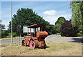
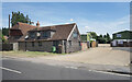
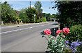
34 photos from this area
Area Information
Key information about the GU3 2DF including its size, population, and administrative classification.
- Area Type
- Postcode
- Area Size
- 27.9 hectares
- Population
- 1618
- Population Density
- 151 people/km²
House Prices in GU3 2DF
35
Properties
£537,550
Average Sold Price
£160,000
Lowest Price
£951,500
Highest Price
Showing 35 properties
| Address | Type | Beds | Baths | Last Sale Price | Last Sale Date | |
|---|---|---|---|---|---|---|
| Oaklands Cottage, 67 Glaziers Lane, Normandy, GU3 2DF | Bungalow | 4 | 2 | £403,000 | Dec 2017 | |
| Syndal, 61 Glaziers Lane, Normandy, GU3 2DF | Detached | 3 | 2 | £930,000 | Aug 2017 | |
| 91 Glaziers Lane, Normandy, GU3 2DF | Detached | 5 | 3 | £400,000 | Jan 2017 | |
| The White House, 57 Glaziers Lane, Normandy, GU3 2DF | house | 2 | - | £951,500 | Nov 2016 | |
| Conifers, 93 Glaziers Lane, Normandy, GU3 2DF | Bungalow | 3 | 2 | £575,000 | Aug 2016 | |
| Jasmine House, 77 Glaziers Lane, Normandy, GU3 2DF | Detached | 4 | 2 | £492,000 | Jun 2007 | |
| Red Lands, 81 Glaziers Lane, Normandy, GU3 2DF | Detached | 4 | 2 | £445,000 | Nov 2004 | |
| The Lane House, 63 Glaziers Lane, Normandy, GU3 2DF | Detached | 5 | 4 | £620,000 | Mar 2004 | |
| Tahoe, 79 Glaziers Lane, Normandy, GU3 2DF | Detached | - | - | £399,000 | Oct 2002 | |
| Brambley Cottage, 87 Glaziers Lane, Normandy, GU3 2DF | Semi-detached | 3 | 2 | £160,000 | Sep 1998 |
Page 1 of 4
Energy Efficiency in GU3 2DF
Amenities
Schools
| Rank | School | Type | Entry gender | Ages |
|---|
Explore more schools in this area
Go to Schools tabDemographics
Household Size
Two person
most common
Accommodation Type
Houses
most common
Tenure
90
majority
Ethnic Group
White
most common
Religion
N/A
most common
Household Composition
N/A
most common
Age
47
median
Adults (30-64 years)
most common
Household Deprivation
N/A
with no deprivation
NS-SEC
42
in Lower managerial occupations
Explore more demographic insights in this area
Go to Demographics tabPlanning
Planning Constraints
- Flood RiskPremium
- Ramsar Wetland SitesPremium
- Area of Outstanding Natural BeautyPremium
- Protected Nature ReservePremium
- Protected WoodlandPremium