Area Overview for GU3 2DA
Photos of GU3 2DA

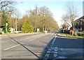

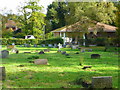

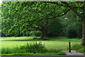

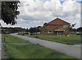
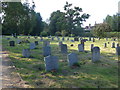
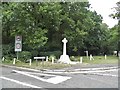
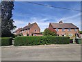

72 photos from this area
Area Information
Key information about the GU3 2DA including its size, population, and administrative classification.
- Area Type
- Postcode
- Area Size
- 11.0 hectares
- Population
- 1496
- Population Density
- 264 people/km²
House Prices in GU3 2DA
24
Properties
£570,722
Average Sold Price
£180,000
Lowest Price
£840,000
Highest Price
Showing 24 properties
| Address | Type | Beds | Baths | Last Sale Price | Last Sale Date | |
|---|---|---|---|---|---|---|
| Tanglewood, Guildford Road, Normandy, GU3 2DA | Detached | 4 | 2 | £610,000 | Dec 2024 | |
| Spinney Cottage, Guildford Road, Normandy, GU3 2DA | Detached | 4 | 3 | £840,000 | Nov 2024 | |
| Greenacres, Guildford Road, Normandy, GU3 2DA | Detached | 4 | 3 | £820,000 | Oct 2024 | |
| Freemoor, Guildford Road, Normandy, GU3 2DA | Detached | - | - | £650,000 | Nov 2023 | |
| Kilrush, Guildford Road, Normandy, GU3 2DA | Bungalow | - | - | £757,500 | Jun 2021 | |
| The Oaks, Guildford Road, Normandy, GU3 2DA | Detached | 4 | 4 | £770,000 | May 2013 | |
| Betelgeuse, Guildford Road, Normandy, GU3 2DA | Detached | 4 | - | £275,000 | Sep 2000 | |
| Rhyddington, Guildford Road, Normandy, GU3 2DA | Bungalow | - | - | £180,000 | Mar 2000 | |
| Tree View Bungalow, Guildford Road, Normandy, GU3 2DA | Bungalow | - | - | £234,000 | Jan 2000 | |
| Wyke Vicarage, Guildford Road, Normandy, GU3 2DA | Detached | 5 | 3 | - | - |
Page 1 of 3
Energy Efficiency in GU3 2DA
Amenities
Schools
| Rank | School | Type | Entry gender | Ages |
|---|
Explore more schools in this area
Go to Schools tabDemographics
Household Size
Two person
most common
Accommodation Type
Houses
most common
Tenure
77
majority
Ethnic Group
White
most common
Religion
N/A
most common
Household Composition
N/A
most common
Age
47
median
Adults (30-64 years)
most common
Household Deprivation
N/A
with no deprivation
NS-SEC
40
in Lower managerial occupations
Explore more demographic insights in this area
Go to Demographics tabPlanning
Planning Constraints
- Flood RiskPremium
- Ramsar Wetland SitesPremium
- Area of Outstanding Natural BeautyPremium
- Protected Nature ReservePremium
- Protected WoodlandPremium