Area Overview for GU29 9XY
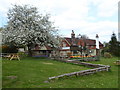
Photos of GU29 9XY


Area Information
GU29 9XY is a small residential cluster in England, home to just 1,970 people. Its compact size means it feels close-knit, with a quiet, settled character. The area’s modest population and low density suggest it is not a high-rise or commercial zone, but rather a place where homes are spaced apart, offering privacy. Daily life here is likely to be unhurried, with a focus on local amenities and community ties. While the postcode covers a limited area, its proximity to nearby towns like Midhurst—home to Sainsburys and Tesco—provides access to essential services without the need to travel far. The demographic profile, with a median age of 47 and a majority of residents aged 30–64, hints at a mature, stable population. This suggests a mix of long-term residents and families, with a focus on comfort and stability over transient lifestyles. For those considering living in GU29 9XY, the area offers a quiet alternative to busier centres, with a clear emphasis on safety and low environmental risk.
- Area Type
- Postcode
- Area Size
- Not available
- Population
- 1970
- Population Density
- Not available
GU29 9XY is a predominantly owner-occupied area, with 49% of homes owned by residents and 51% likely rented. The accommodation type is almost exclusively houses, which is unusual for a small postcode but suggests a focus on single-family living rather than flats or apartments. This housing stock is likely to appeal to those seeking space and privacy, though the low population density may mean properties are spread out. The small size of the area means the property market is limited, with few options available within the postcode itself. Buyers may need to look to nearby towns like Midhurst for more choices, though proximity to retail hubs such as Sainsburys and Tesco could offset the lack of local amenities. The owner-occupied nature of the area implies a stable market, but the limited number of homes means competition could be fierce for available properties.
House Prices in GU29 9XY
No properties found in this postcode.
Energy Efficiency in GU29 9XY
Residents of GU29 9XY have access to nearby retail amenities in Midhurst, including Sainsburys, Spar, and Tesco, which provide essential shopping and dining options. While the area itself may lack large-scale leisure facilities, its proximity to Midhurst ensures residents can access a broader range of services. The absence of named parks or recreational spaces in the data suggests that outdoor activities may require travel to nearby towns. However, the low crime risk and quiet environment contribute to a sense of safety and calm, ideal for those seeking a relaxed lifestyle. The combination of local retail and nearby services creates a functional, if modest, daily life. For those prioritising convenience, the area’s proximity to Midhurst’s amenities is a key advantage, balancing the need for privacy with access to essential services.
Amenities
Schools
| Rank | School | Type | Entry gender | Ages |
|---|
Explore more schools in this area
Go to Schools tabDemographics
The population of GU29 9XY is predominantly adults aged 30–64, with a median age of 47. This indicates a community that is neither heavily young nor elderly, but rather one rooted in middle-age stability. Home ownership stands at 49%, meaning nearly half of properties are owner-occupied, while the remaining 51% are likely rented. The accommodation type is primarily houses, which aligns with the area’s low density and residential character. The predominant ethnic group is White, with no data provided on other ethnicities. This suggests a relatively homogenous population, though the absence of diversity statistics should not be interpreted as a lack of it. The low crime risk score of 84 (a safety pass) implies a secure environment, which may appeal to families seeking stability. The area’s demographics paint a picture of a mature, settled community with a focus on long-term living rather than short-term rental trends.
Household Size
Accommodation Type
Tenure
Ethnic Group
Religion
Household Composition
Age
Household Deprivation
NS-SEC
Explore more demographic insights in this area
Go to Demographics tabPlanning
Planning Constraints
- Flood RiskPremium
- Ramsar Wetland SitesPremium
- Area of Outstanding Natural BeautyPremium
- Protected Nature ReservePremium
- Protected WoodlandPremium