Area Overview for GU29 9TS
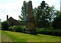
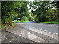
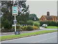
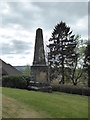
Photos of GU29 9TS


Area Information
Living in GU29 9TS means being part of a small, tightly knit residential cluster in England, where the population of 1,031 people spreads across 47 people per square kilometre. This is a quiet, low-density area, ideal for those seeking a peaceful, community-focused lifestyle. The area’s compact nature ensures that amenities and services are within practical reach, while its modest size fosters a sense of familiarity among residents. With a median age of 47, the community is largely composed of adults aged 30–64, suggesting a stable demographic with established households. The area’s low flood risk and absence of environmental constraints make it a practical choice for long-term living. For those prioritising safety, the area scores 90 out of 100 for crime risk, reflecting below-average incidents. Whether you’re drawn to the simplicity of a small postcode area or the convenience of nearby retail, GU29 9TS offers a straightforward, uncluttered way of life.
- Area Type
- Postcode
- Area Size
- Not available
- Population
- 1031
- Population Density
- 47 people/km²
The property market in GU29 9TS is characterised by a high rate of home ownership—68% of residents own their homes. This suggests a community where long-term residency is common, with fewer rental properties available. The accommodation type is predominantly houses, which, given the area’s low population density, implies a focus on single-family homes rather than apartments or flats. For buyers, this means a limited but stable housing stock, with properties likely to be in established, well-maintained condition. The small size of the area means that the immediate surroundings are also likely to mirror this pattern, with limited new developments. Buyers should consider that the market may not cater to those seeking rental properties or high-density living, but for those prioritising ownership and a quiet, residential setting, GU29 9TS offers a straightforward proposition.
House Prices in GU29 9TS
No properties found in this postcode.
Energy Efficiency in GU29 9TS
The lifestyle in GU29 9TS is shaped by its proximity to essential retail services, with five notable venues within practical reach, including Sainsburys Midhurst, Spar, and Tesco Midhurst. These shops provide access to groceries, convenience items, and everyday essentials, supporting a self-contained lifestyle. While the area lacks detailed information on parks or leisure facilities, the presence of multiple retail options indicates a focus on practical convenience. For residents, this means a straightforward daily routine with minimal need to travel beyond the immediate area for basic needs. The retail mix suggests a community that values accessibility and ease of access to services, though those seeking more extensive leisure or recreational options may need to look further afield.
Amenities
Schools
The nearest school to GU29 9TS is West Lavington CofE First School, a primary school serving the local community. While no Ofsted rating is provided, the presence of a primary school indicates that families with young children have access to essential educational infrastructure. The absence of secondary schools or further education institutions in the immediate area means that students may need to travel to nearby towns for higher-level schooling. For families prioritising primary education, the proximity of West Lavington CofE First School is a clear advantage. However, those requiring a broader range of educational options may need to look beyond the immediate postcode area. The single school listed reflects the modest scale of the community and its focus on basic amenities.
| Rank | School | Type | Entry gender | Ages |
|---|
Explore more schools in this area
Go to Schools tabDemographics
The community in GU29 9TS is predominantly made up of adults aged 30–64, with a median age of 47. This suggests a population that is largely settled, with few young families or elderly residents. Home ownership is high at 68%, indicating that most residents live in properties they own rather than rent. The accommodation type is primarily houses, which aligns with the area’s low population density and suburban character. The predominant ethnic group is White, though no further breakdown of diversity is provided. The absence of specific data on deprivation means the quality of life cannot be assessed in detail, but the low crime risk and environmental safety scores suggest a stable, secure environment. This profile paints a picture of a mature, owner-occupied community with a focus on stability over rapid change.
Household Size
Accommodation Type
Tenure
Ethnic Group
Religion
Household Composition
Age
Household Deprivation
NS-SEC
Explore more demographic insights in this area
Go to Demographics tabPlanning
Planning Constraints
- Flood RiskPremium
- Ramsar Wetland SitesPremium
- Area of Outstanding Natural BeautyPremium
- Protected Nature ReservePremium
- Protected WoodlandPremium