Area Overview for GU29 9TN
Photos of GU29 9TN


Area Information
Living in GU29 9TN means being part of a small, tightly knit residential cluster in England. With a population of 1,031 and a density of 47 people per square kilometre, this area feels quiet and unassuming. It is not a sprawling suburb but a compact community where daily life unfolds at a measured pace. The postcode covers a limited geographical footprint, making it ideal for those seeking a peaceful, low-traffic environment. Its proximity to Midhurst and surrounding villages offers access to broader amenities without the congestion of larger towns. The area’s character is defined by its modest scale—fewer than 1,000 residents, most of whom are adults aged 30–64. This demographic suggests a community rooted in stability, with homeownership rates at 68%, indicating a preference for long-term residence over rental properties. For buyers, GU29 9TN presents a rare opportunity to own a home in a locale that balances seclusion with practical connectivity to nearby services and transport links.
- Area Type
- Postcode
- Area Size
- Not available
- Population
- 1031
- Population Density
- 47 people/km²
The property market in GU29 9TN is defined by its high home ownership rate—68% of residents own their homes—suggesting a market skewed towards owner-occupation rather than rental demand. The accommodation type is predominantly houses, which is typical of rural and semi-rural areas where larger properties are more common. This contrasts with urban centres where flats and apartments dominate. The small population and limited geographical spread mean the housing stock is finite, with few new developments likely to emerge. For buyers, this creates a niche market where properties are likely to be well-maintained and sought after by those prioritising stability and space. The lack of rental activity also implies lower turnover, meaning homes may remain on the market for longer periods. Those considering purchase should view this as an opportunity to secure a property in a low-risk, low-density environment with strong local ties.
House Prices in GU29 9TN
No properties found in this postcode.
Energy Efficiency in GU29 9TN
The lifestyle in GU29 9TN is shaped by its proximity to retail amenities, including Sainsburys Midhurst, Spar, and Tesco Midhurst. These stores provide essential shopping options, from groceries to everyday necessities, reducing the need for long journeys to larger centres. While the data does not mention dining, parks, or leisure facilities, the presence of multiple retail outlets suggests a basic level of convenience for daily living. The area’s small size means amenities are likely concentrated in nearby villages, encouraging a community-oriented approach to leisure and socialising. For residents, this balance of practical retail access and the potential for nearby natural or cultural attractions offers a lifestyle that combines simplicity with functional ease. The absence of specific data on parks or dining does not detract from the area’s appeal, as its core strengths lie in its quiet, low-density environment and reliable connectivity.
Amenities
Schools
The nearest school to GU29 9TN is West Lavington CofE First School, a primary institution serving the local community. While no Ofsted rating is provided, the presence of a primary school indicates that families with young children have access to foundational education within the area. The absence of secondary schools or further education facilities means residents may need to travel to nearby towns for higher-level schooling. This dynamic is common in smaller postcode areas where educational infrastructure is concentrated in larger centres. For families prioritising proximity to schools, West Lavington’s primary offering is a practical resource, though planning for secondary education would require consideration of commuting options. The single school listed reflects the modest scale of the area, with no indication of additional educational institutions nearby.
| Rank | School | Type | Entry gender | Ages |
|---|
Explore more schools in this area
Go to Schools tabDemographics
The population of GU29 9TN is predominantly adults aged 30–64, with a median age of 47. This suggests a mature, established community where many residents are likely in their peak working years or nearing retirement. Home ownership is high, at 68%, compared to the national average, indicating a strong preference for private residences over rental properties. The area is characterised by houses rather than flats, reflecting a traditional, family-oriented housing stock. The predominant ethnic group is White, which aligns with broader trends in rural England. The absence of specific data on deprivation or diversity means the area’s social fabric remains largely unexamined in public records, but the demographic profile points to a stable, low-turnover population. For prospective buyers, this suggests a community with long-term residents who value continuity and a sense of place.
Household Size
Accommodation Type
Tenure
Ethnic Group
Religion
Household Composition
Age
Household Deprivation
NS-SEC
Explore more demographic insights in this area
Go to Demographics tabPlanning
Planning Constraints
- Flood RiskPremium
- Ramsar Wetland SitesPremium
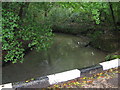
- Area of Outstanding Natural BeautyPremium
- Protected Nature ReservePremium
- Protected WoodlandPremium