Area Overview for GU29 9PP
Photos of GU29 9PP
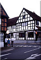
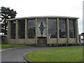
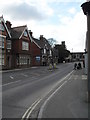
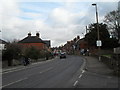
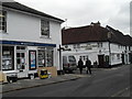
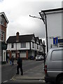
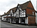
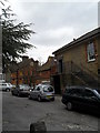
100 photos from this area
Area Information
Key information about the GU29 9PP including its size, population, and administrative classification.
- Area Type
- Postcode
- Area Size
- 1.7 hectares
- Population
- 1495
- Population Density
- 1827 people/km²
House Prices in GU29 9PP
34
Properties
£307,674
Average Sold Price
£90,000
Lowest Price
£535,000
Highest Price
Showing 34 properties
| Address | Type | Beds | Baths | Last Sale Price | Last Sale Date | |
|---|---|---|---|---|---|---|
| 34 Pretoria Avenue, Midhurst, GU29 9PP | Detached | 4 | 1 | £535,000 | May 2024 | |
| 36 Pretoria Avenue, Midhurst, GU29 9PP | Detached | 4 | 1 | £525,000 | Jun 2023 | |
| 35 Pretoria Avenue, Midhurst, GU29 9PP | Detached | 3 | 1 | £460,000 | Mar 2023 | |
| 26 Pretoria Avenue, Midhurst, GU29 9PP | Detached | 3 | 1 | £523,000 | Nov 2022 | |
| 15 Pretoria Avenue, Midhurst, GU29 9PP | Semi-detached | 3 | 2 | £345,000 | Aug 2017 | |
| 32 Pretoria Avenue, Midhurst, GU29 9PP | Detached | 4 | 2 | £462,500 | Jul 2017 | |
| 37 Pretoria Avenue, Midhurst, GU29 9PP | Semi-detached | 3 | 1 | £347,500 | Dec 2015 | |
| 41 Pretoria Avenue, Midhurst, GU29 9PP | house | 3 | - | £350,000 | May 2013 | |
| 43 Pretoria Avenue, Midhurst, GU29 9PP | Detached | 3 | - | £275,000 | May 2013 | |
| 28 Pretoria Avenue, Midhurst, GU29 9PP | Semi-detached | 3 | - | £270,000 | Apr 2013 |
Page 1 of 4
Energy Efficiency in GU29 9PP
Amenities
Schools
| Rank | School | Type | Entry gender | Ages |
|---|
Explore more schools in this area
Go to Schools tabDemographics
Household Size
One person
most common
Accommodation Type
Houses
most common
Tenure
76
majority
Ethnic Group
White
most common
Religion
N/A
most common
Household Composition
N/A
most common
Age
47
median
Adults (30-64 years)
most common
Household Deprivation
N/A
with no deprivation
NS-SEC
40
in Lower managerial occupations
Explore more demographic insights in this area
Go to Demographics tabPlanning
Planning Constraints
- Flood RiskPremium
- Ramsar Wetland SitesPremium
- Area of Outstanding Natural BeautyPremium
- Protected Nature ReservePremium
- Protected WoodlandPremium