Area Overview for GU29 9FY
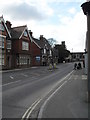
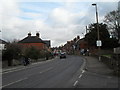
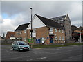
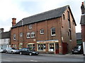
Photos of GU29 9FY


Area Information
GU29 9FY is a compact residential postcode in England, covering 5,779 square metres and home to 1,905 residents. Its population density of 979 people per square kilometre suggests a tightly knit community, with homes clustered closely together. Daily life here is shaped by its small-scale nature, where proximity to local amenities and schools is a key feature. The area’s character is defined by its mix of established housing and quiet residential streets, offering a balance between privacy and accessibility. With no major infrastructure or industrial zones nearby, GU29 9FY leans into a suburban feel, where neighbours are likely to be long-term residents. The presence of multiple schools within reach, including Midhurst Rother College with an outstanding Ofsted rating, adds to its appeal for families. While the area is small, its connectivity to nearby towns via roads and rail ensures access to broader services without the congestion of larger urban centres. For those prioritising a low-maintenance, community-focused lifestyle, GU29 9FY presents a straightforward, uncluttered living environment.
- Area Type
- Postcode
- Area Size
- 5779 m²
- Population
- 1905
- Population Density
- 979 people/km²
GU29 9FY is a predominantly owner-occupied area, with 61% of residents living in their own homes. The housing stock is largely composed of houses, which is typical for smaller, low-density residential zones. This suggests a market where property ownership is prioritised over rental, possibly due to the area’s quiet, suburban appeal. The limited size of the postcode—just 5,779 square metres—means the housing stock is relatively small, with fewer options for buyers compared to larger towns or cities. For those considering this area, the focus on houses implies a preference for standalone properties rather than apartments or flats. The low population density also means that developments are likely to be spread out, with larger plots of land. Buyers should note that the market here is niche, catering to those seeking a private, low-traffic environment rather than a high-demand urban location.
House Prices in GU29 9FY
Showing 17 properties
| Address | Type | Beds | Baths | Last Sale Price | Last Sale Date | |
|---|---|---|---|---|---|---|
| 8 Gilbert Hannam Close, Midhurst, GU29 9FY | Terraced | 3 | 2 | £440,000 | Jan 2022 | |
| 7 Gilbert Hannam Close, Midhurst, GU29 9FY | house | - | - | £495,000 | Dec 2017 | |
| 4 Gilbert Hannam Close, Midhurst, GU29 9FY | house | - | - | £540,000 | Oct 2017 | |
| 10 Gilbert Hannam Close, Midhurst, GU29 9FY | house | - | - | £555,000 | Jun 2017 | |
| 9 Gilbert Hannam Close, Midhurst, GU29 9FY | house | - | - | £472,500 | Jun 2017 | |
| 3 Gilbert Hannam Close, Midhurst, GU29 9FY | Terraced | 3 | 3 | £530,000 | Apr 2017 | |
| 5 Gilbert Hannam Close, Midhurst, GU29 9FY | house | - | - | £394,000 | Apr 2017 | |
| 2 Gilbert Hannam Close, Midhurst, GU29 9FY | Terraced | 3 | 4 | £535,000 | Mar 2017 | |
| 6 Gilbert Hannam Close, Midhurst, GU29 9FY | Detached | 2 | 1 | £329,950 | Jan 2017 | |
| 1 Gilbert Hannam Close, Midhurst, GU29 9FY | Terraced | 3 | 3 | £565,000 | Dec 2016 |
Energy Efficiency in GU29 9FY
Residents of GU29 9FY have access to a modest selection of retail amenities, including Tesco Midhurst, Spar, and M&S Midhurst BP. These stores provide essential shopping options for groceries, fuel, and everyday items, reducing the need for longer trips to larger towns. While the area lacks detailed information on dining or leisure facilities, the presence of multiple retail outlets suggests a functional, practical approach to daily living. The compact nature of the postcode means that amenities are closely clustered, making them easily reachable on foot or by car. This convenience supports a low-effort lifestyle, where errands and shopping can be completed without significant travel time. The character of the area is defined by its simplicity—prioritising accessibility and ease over expansive leisure options. For those who value proximity to essential services without the noise of urban centres, GU29 9FY offers a straightforward, no-frills living experience.
Amenities
Schools
GU29 9FY is served by a range of schools, including Midhurst Grammar School, a primary school, and St Margaret’s Senior School and St Margaret’s School, both independent institutions. The area also benefits from Midhurst Rother College, an academy with an outstanding Ofsted rating. This mix of state and independent education options provides families with flexibility, whether they prioritise free education or seek the structured environment of private schooling. The presence of a high-performing academy like Midhurst Rother College is a significant draw, offering students access to quality teaching and facilities. For parents, the proximity of multiple schools within a short distance reduces the need for long commutes, enhancing convenience. The diversity in school types reflects the area’s appeal to a range of household preferences, from those seeking affordability to those investing in elite education.
| Rank | School | Type | Entry gender | Ages |
|---|
Explore more schools in this area
Go to Schools tabDemographics
The population of GU29 9FY skews towards adults aged 30–64, with a median age of 47. This suggests a mature, settled community, likely with established careers and families. Home ownership stands at 61%, indicating a majority of residents live in their own homes rather than renting. The accommodation type is predominantly houses, which aligns with the area’s suburban character and lower density compared to urban zones. The predominant ethnic group is White, reflecting a homogenous demographic profile. With no data on deprivation levels, it is unclear how economic factors influence quality of life here, but the low crime score of 74/100 suggests a generally stable environment. The age profile implies a focus on long-term residency, with fewer young families or retirees compared to areas with younger or older populations. This demographic structure may influence local services and amenities, which are tailored to the needs of middle-aged households.
Household Size
Accommodation Type
Tenure
Ethnic Group
Religion
Household Composition
Age
Household Deprivation
NS-SEC
Explore more demographic insights in this area
Go to Demographics tabPlanning
Planning Constraints
- Flood RiskPremium
- Ramsar Wetland SitesPremium
- Area of Outstanding Natural BeautyPremium
- Protected Nature ReservePremium
- Protected WoodlandPremium