Area Overview for GU29 9DD
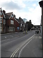
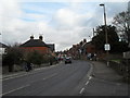
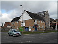
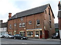
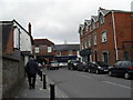
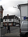
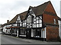
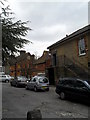
Photos of GU29 9DD


Area Information
GU29 9DD is a small residential postcode area in England, covering 968 square metres and home to 1,905 residents. Its compact size means it feels like a close-knit community, with a population density of 979 people per square kilometre. The area is defined by its cluster of homes, predominantly owner-occupied, and a median age of 47 suggests a mature demographic, with adults aged 30–64 forming the largest group. Daily life here is likely shaped by the proximity to local amenities and schools, offering a balance between suburban comfort and accessibility. While the area lacks large-scale infrastructure, its small footprint ensures a quieter, more intimate living experience. Residents benefit from nearby retail options, including Spar, Tesco Midhurst, and Sainsburys Midhurst, which cater to everyday needs. The presence of both state and independent schools reflects a range of educational choices, though the area’s limited size means it is not a major commuter hub. For those seeking a low-maintenance, family-friendly environment with minimal urban sprawl, GU29 9DD presents a distinct proposition.
- Area Type
- Postcode
- Area Size
- 968 m²
- Population
- 1905
- Population Density
- 979 people/km²
The property market in GU29 9DD is dominated by owner-occupied homes, with 61% of properties owned by residents rather than rented. This indicates a community of long-term residents rather than a transient rental market. The area’s housing stock consists primarily of houses, which is typical for smaller rural or semi-rural postcodes. Given the area’s size—just 968 square metres—the housing stock is likely limited in volume, making it a niche market for buyers seeking a quiet, low-density environment. The focus on owner-occupation suggests that properties here are often held for the long term, with fewer short-term lettings or speculative investments. For buyers, this means a market where properties may be available for purchase but require careful consideration of the area’s small scale and limited expansion potential.
House Prices in GU29 9DD
No properties found in this postcode.
Energy Efficiency in GU29 9DD
The lifestyle in GU29 9DD is shaped by its proximity to essential retail services, including Spar, Tesco Midhurst, and Sainsburys Midhurst. These stores provide convenient access to groceries, household goods, and everyday essentials, reducing the need for long trips to larger centres. While the area lacks detailed information on parks or leisure facilities, the presence of multiple retail outlets suggests a focus on practicality and convenience. The compact nature of the postcode means amenities are likely within walking or short driving distance, supporting a low-maintenance lifestyle. For residents prioritising ease of access to shopping and local services, GU29 9DD offers a straightforward, functional environment.
Amenities
Schools
Residents of GU29 9DD have access to a range of educational institutions, including Midhurst Grammar School, a primary school, and St Margaret’s Senior School and St Margaret’s School, both independent institutions. The area also benefits from Midhurst Rother College, an academy rated ‘outstanding’ by Ofsted. This mix of school types provides families with options, from state-funded education to private schooling. The presence of an outstanding-rated academy suggests high-quality secondary education nearby, which is a significant draw for families prioritising academic standards. However, the small size of GU29 9DD means these schools are likely within a short commute, reinforcing the area’s appeal for those seeking a balance between local amenities and quality schooling.
| Rank | School | Type | Entry gender | Ages |
|---|
Explore more schools in this area
Go to Schools tabDemographics
The community in GU29 9DD is predominantly composed of adults aged 30–64, with a median age of 47. This suggests a stable population with established careers and families. Home ownership is high at 61%, indicating a strong presence of long-term residents. The area is characterised by houses rather than flats, reflecting a traditional housing stock. The predominant ethnic group is White, though specific data on diversity is not provided. With a population density of 979 people per square kilometre, the area is moderately populated but not overcrowded. This density, combined with the age profile, implies a community focused on stability and continuity. The absence of detailed deprivation data means it is unclear how economic factors influence quality of life, but the high home ownership rate and age distribution suggest a relatively secure demographic.
Household Size
Accommodation Type
Tenure
Ethnic Group
Religion
Household Composition
Age
Household Deprivation
NS-SEC
Explore more demographic insights in this area
Go to Demographics tabPlanning
Planning Constraints
- Flood RiskPremium
- Ramsar Wetland SitesPremium
- Area of Outstanding Natural BeautyPremium
- Protected Nature ReservePremium
- Protected WoodlandPremium