Area Overview for GU29 9BN
Photos of GU29 9BN
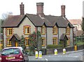
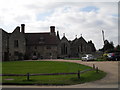
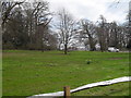
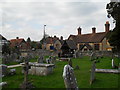
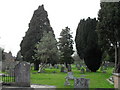
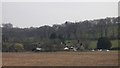
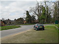
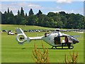

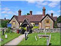
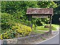
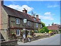
81 photos from this area
Area Information
Key information about the GU29 9BN including its size, population, and administrative classification.
- Area Type
- Postcode
- Area Size
- 7.7 hectares
- Population
- 1588
- Population Density
- 240 people/km²
House Prices in GU29 9BN
11
Properties
£333,333
Average Sold Price
£200,000
Lowest Price
£575,000
Highest Price
Showing 11 properties
| Address | Type | Beds | Baths | Last Sale Price | Last Sale Date | |
|---|---|---|---|---|---|---|
| 379 Easebourne Lane, Easebourne, GU29 9BN | Terraced | 1 | 1 | £225,000 | Jun 2015 | |
| Sycamore House, Easebourne Lane, Easebourne, GU29 9BN | Detached | 3 | 2 | £575,000 | Jul 2014 | |
| The Cottage, Easebourne Lane, Easebourne, GU29 9BN | Detached | - | - | £200,000 | Jun 2000 | |
| Cowdray Game Larder, Easebourne Lane, Easebourne, GU29 9BN | Farm | - | - | - | - | |
| 380 Easebourne Lane, Easebourne, GU29 9BN | house | - | - | - | - | |
| Conifers School Playing Field, Easebourne Lane, Easebourne, GU29 9BN | Leisure | - | - | - | - | |
| Lychgate Cottage, Easebourne Lane, Easebourne, GU29 9BN | house | - | - | - | - | |
| Bunch Cottage, 378 Easebourne Lane, Easebourne, GU29 9BN | house | - | - | - | - | |
| Rose Cottage, 381 Easebourne Lane, Easebourne, GU29 9BN | house | - | - | - | - | |
| Wood Cote, 382 Easebourne Lane, Easebourne, GU29 9BN | house | - | - | - | - |
Page 1 of 2
Energy Efficiency in GU29 9BN
Amenities
Schools
| Rank | School | Type | Entry gender | Ages |
|---|
Explore more schools in this area
Go to Schools tabDemographics
Household Size
Two person
most common
Accommodation Type
Houses
most common
Tenure
72
majority
Ethnic Group
White
most common
Religion
N/A
most common
Household Composition
N/A
most common
Age
47
median
Adults (30-64 years)
most common
Household Deprivation
N/A
with no deprivation
NS-SEC
45
in Lower managerial occupations
Explore more demographic insights in this area
Go to Demographics tabPlanning
Planning Constraints
- Flood RiskPremium
- Ramsar Wetland SitesPremium
- Area of Outstanding Natural BeautyPremium
- Protected Nature ReservePremium
- Protected WoodlandPremium