Area Overview for GU29 0PJ
Photos of GU29 0PJ
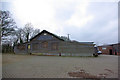
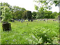
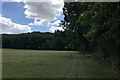
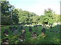
18 photos from this area
Area Information
Key information about the GU29 0PJ including its size, population, and administrative classification.
- Area Type
- Postcode
- Area Size
- 89.1 hectares
- Population
- 1127
- Population Density
- 42 people/km²
House Prices in GU29 0PJ
12
Properties
£651,869
Average Sold Price
£392,100
Lowest Price
£1,300,000
Highest Price
Showing 12 properties
| Address | Type | Beds | Baths | Last Sale Price | Last Sale Date | |
|---|---|---|---|---|---|---|
| Robins Hill, Iping Lane, Iping, GU29 0PJ | Bungalow | - | - | £1,300,000 | Nov 2020 | |
| Robins Cottage, Iping Lane, Iping, GU29 0PJ | house | - | - | £632,243 | May 2015 | |
| Knapp Cottage, Iping Lane, Iping, GU29 0PJ | Semi-detached | - | - | £500,000 | Dec 2004 | |
| Robins Bottom Cottage, Iping Lane, Iping, GU29 0PJ | Detached | 3 | - | £435,000 | Nov 1998 | |
| Knapp House, Iping Lane, Iping, GU29 0PJ | Detached | 5 | - | £392,100 | Jun 1996 | |
| Caravan, Robins Barn, Iping Lane, Iping, GU29 0PJ | undefined | - | - | - | - | |
| Robins Farm, Iping Lane, Iping, GU29 0PJ | Farm | - | - | - | - | |
| Moor House, Iping Lane, Iping, GU29 0PJ | house | - | - | - | - | |
| Robins, Iping Lane, Iping, GU29 0PJ | Detached | - | - | - | - | |
| Woodpeckers, Iping Lane, Iping, GU29 0PJ | house | - | - | - | - |
Page 1 of 2
Energy Efficiency in GU29 0PJ
Amenities
Schools
| Rank | School | Type | Entry gender | Ages |
|---|
Explore more schools in this area
Go to Schools tabDemographics
Household Size
Two person
most common
Accommodation Type
Houses
most common
Tenure
80
majority
Ethnic Group
White
most common
Religion
N/A
most common
Household Composition
N/A
most common
Age
47
median
Adults (30-64 years)
most common
Household Deprivation
N/A
with no deprivation
NS-SEC
48
in Lower managerial occupations
Explore more demographic insights in this area
Go to Demographics tabPlanning
Planning Constraints
- Flood RiskPremium
- Ramsar Wetland SitesPremium
- Area of Outstanding Natural BeautyPremium
- Protected Nature ReservePremium
- Protected WoodlandPremium