Area Overview for GU29 0PE
Photos of GU29 0PE
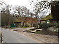

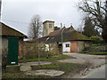
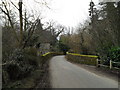
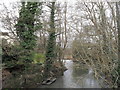
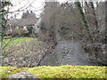
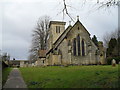
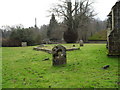
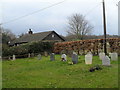

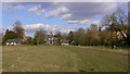
85 photos from this area
Area Information
Key information about the GU29 0PE including its size, population, and administrative classification.
- Area Type
- Postcode
- Area Size
- 25.9 hectares
- Population
- 1234
- Population Density
- 47 people/km²
House Prices in GU29 0PE
17
Properties
£957,084
Average Sold Price
£282,510
Lowest Price
£1,850,000
Highest Price
Showing 17 properties
| Address | Type | Beds | Baths | Last Sale Price | Last Sale Date | |
|---|---|---|---|---|---|---|
| Stable Cottage, Iping Lane, Iping, GU29 0PE | Semi-detached | 3 | 1 | £812,500 | Feb 2025 | |
| The Pheasantry, Iping Lane, Iping, GU29 0PE | Detached | 4 | 3 | £1,550,000 | Apr 2023 | |
| Iping Barn, Iping Lane, Iping, GU29 0PE | house | - | - | £975,000 | Feb 2021 | |
| The Vinery, Iping Lane, Iping, GU29 0PE | Bungalow | 4 | 2 | £975,000 | Jul 2019 | |
| Iping Mill, Iping Lane, Iping, GU29 0PE | Flat | 5 | 4 | £1,040,000 | May 2019 | |
| The Blotting House, Iping Lane, Iping, GU29 0PE | house | 4 | 2 | £1,225,000 | Jan 2017 | |
| River House, Iping Lane, Iping, GU29 0PE | house | - | - | £680,000 | Nov 2015 | |
| Coachmans Cottage, Iping Lane, Iping, GU29 0PE | Semi-detached | 3 | 1 | £495,000 | Feb 2015 | |
| 1, New Cottage, Iping Lane, Iping, GU29 0PE | house | 2 | 1 | £282,510 | Dec 2014 | |
| Kismet, Iping Lane, Iping, GU29 0PE | Semi-detached | 5 | 2 | £550,000 | Sep 2014 |
Page 1 of 2
Energy Efficiency in GU29 0PE
Amenities
Schools
| Rank | School | Type | Entry gender | Ages |
|---|
Explore more schools in this area
Go to Schools tabDemographics
Household Size
Two person
most common
Accommodation Type
Houses
most common
Tenure
70
majority
Ethnic Group
White
most common
Religion
N/A
most common
Household Composition
N/A
most common
Age
47
median
Adults (30-64 years)
most common
Household Deprivation
N/A
with no deprivation
NS-SEC
42
in Lower managerial occupations
Explore more demographic insights in this area
Go to Demographics tabPlanning
Planning Constraints
- Flood RiskPremium
- Ramsar Wetland SitesPremium
- Area of Outstanding Natural BeautyPremium
- Protected Nature ReservePremium
- Protected WoodlandPremium