Area Overview for GU29 0LP
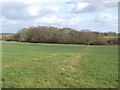
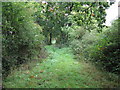
Photos of GU29 0LP


Area Information
Living in GU29 0LP offers a quiet, low-density lifestyle in a small residential cluster. With a population of 1,234 and a density of 47 people per square kilometre, the area feels unspoiled and intimate. This postcode sits in a rural or semi-rural setting, likely surrounded by open spaces or smaller communities. Daily life here is likely characterised by a slower pace, with local amenities such as Sainsburys Midhurst, Spar, and Tesco Midhurst within reach. The area’s safety profile is strong, with a crime risk score of 76/100, indicating below-average crime rates. For those seeking a peaceful, family-oriented environment, GU29 0LP provides a sense of security and space. Its proximity to retail and schools suggests it caters to local needs without the congestion of larger towns. The lack of environmental constraints, such as protected woodlands or AONB coverage, means development is unlikely to be restricted, offering potential for stability in property values. This area is ideal for those prioritising safety, community cohesion, and a low-key lifestyle.
- Area Type
- Postcode
- Area Size
- Not available
- Population
- 1234
- Population Density
- 47 people/km²
GU29 0LP is primarily an owner-occupied area, with 70% of properties owned by residents rather than rented. The accommodation type is predominantly houses, which suggests a focus on family homes and private living spaces. This contrasts with areas dominated by flats or rental properties, where turnover is higher. The small population and low density imply a limited housing stock, likely centred on detached or semi-detached homes. For buyers, this means competition may be lower than in larger towns, but the pool of available properties could be restricted. The lack of planning constraints, such as protected woodlands or AONB coverage, means development is unlikely to be hindered, potentially offering long-term stability. However, the area’s small size means buyers should consider nearby towns for broader options. The emphasis on owner-occupation suggests a community of long-term residents, which could influence property value trends.
House Prices in GU29 0LP
No properties found in this postcode.
Energy Efficiency in GU29 0LP
Residents of GU29 0LP have access to nearby retail amenities, including Sainsburys Midhurst, Spar, and Tesco Midhurst, which provide essential shopping and daily necessities. These stores are likely within a short drive or walk, supporting a convenient lifestyle. The area’s low population density and lack of large retail hubs suggest a focus on local, small-scale commerce. While the data does not mention dining or leisure venues, the presence of multiple supermarkets indicates a community prioritising practicality over extensive entertainment options. The absence of parks or recreational facilities in the data means outdoor activities may require travel to nearby towns. However, the area’s safety and low crime risk contribute to a sense of security for residents. Overall, lifestyle in GU29 0LP is practical, with amenities tailored to local needs rather than urban convenience.
Amenities
Schools
Near GU29 0LP are Stedham Primary School, which has an Ofsted rating of satisfactory, and St Cuthman’s School, Stedham, a special school. The presence of both a primary school and a special school indicates a range of educational options for families. Stedham Primary School’s satisfactory rating suggests it meets basic standards but may have areas for improvement, while St Cuthman’s School caters to students with specific needs. This combination is beneficial for families with children requiring tailored support or those seeking a mainstream education. The proximity of these schools within practical reach reduces commuting times for parents. However, the absence of secondary schools in the data means families may need to look further afield for comprehensive education. The mix of school types reflects the area’s focus on local, community-based learning rather than large, multi-phase institutions.
| Rank | School | Type | Entry gender | Ages |
|---|
Explore more schools in this area
Go to Schools tabDemographics
The population of GU29 0LP is predominantly adults aged 30–64, with a median age of 47. This suggests a mature, possibly family-oriented community. Home ownership is high at 70%, with houses being the primary accommodation type. The predominant ethnic group is White, which aligns with the area’s likely rural or semi-rural character. The absence of specific deprivation data means no direct commentary on economic hardship, but the high home ownership rate and stable age profile imply a relatively secure, settled population. The age range indicates a mix of established residents and families, which may influence local services and amenities. With no mention of diversity metrics, the community appears homogenous, which could affect social dynamics. The low population density further supports a lifestyle focused on private space and local connectivity rather than urban amenities.
Household Size
Accommodation Type
Tenure
Ethnic Group
Religion
Household Composition
Age
Household Deprivation
NS-SEC
Explore more demographic insights in this area
Go to Demographics tabPlanning
Planning Constraints
- Flood RiskPremium
- Ramsar Wetland SitesPremium
- Area of Outstanding Natural BeautyPremium
- Protected Nature ReservePremium
- Protected WoodlandPremium