Area Overview for GU29 0BL
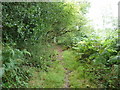
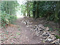
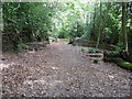
Photos of GU29 0BL


Area Information
Living in GU29 0BL means being part of a small, tightly knit residential cluster in England. With a population of 1,588 spread across a density of 240 people per square kilometre, this area offers a quiet, low-density lifestyle. The community is predominantly composed of adults aged 30–64, reflecting a mature demographic profile. Daily life here is characterised by proximity to essential services and a mix of local amenities. While the area is small, it is well-served by nearby towns such as Midhurst, which provide broader retail, leisure, and transport options. The low population density suggests a focus on private homes rather than high-rise development, aligning with the 72% home ownership rate. For those seeking a balance between rural tranquillity and accessible town facilities, GU29 0BL provides a compact, self-contained environment. Its modest size means residents are likely to know their neighbours, and the area’s safety record adds to its appeal. Whether commuting to nearby centres or enjoying local walks, GU29 0BL offers a straightforward, uncluttered way of living.
- Area Type
- Postcode
- Area Size
- Not available
- Population
- 1588
- Population Density
- 240 people/km²
The property market in GU29 0BL is dominated by owner-occupied homes, with 72% of properties owned by residents rather than rented. This high home ownership rate suggests a community of long-term residents rather than a transient rental market. The accommodation type is predominantly houses, which is typical for small rural clusters where larger plots are available. Given the area’s size and the focus on single-family homes, the housing stock is likely to be older, with fewer apartments or high-density developments. Buyers should consider that the small population and limited land area mean property availability is constrained. Those seeking a family home or a retirement property may find the existing stock suitable, though new builds are unlikely. The proximity to nearby towns like Midhurst could also influence property values, as residents may commute to larger centres for work or amenities.
House Prices in GU29 0BL
No properties found in this postcode.
Energy Efficiency in GU29 0BL
The lifestyle in GU29 0BL is shaped by its proximity to local amenities and the character of nearby towns. Within practical reach are five retail outlets, including M&S Midhurst BP, Tesco Midhurst, and Spar, offering everyday shopping needs. Two railway stations—Liphook and Haslemere—connect residents to broader transport networks, enabling travel to nearby towns for leisure, work, or specialist services. While the area itself lacks large parks or leisure facilities, the surrounding region likely includes natural spaces for walking or recreation. The retail options suggest a focus on convenience rather than luxury, with local shops catering to daily essentials. The modest scale of amenities aligns with the area’s small population, creating a self-contained but limited environment. Residents may need to travel further for cultural or entertainment options, but the nearby towns provide a counterbalance to the area’s quiet charm.
Amenities
Schools
Residents of GU29 0BL have access to a range of school options within practical reach. Easebourne CofE Primary School, a state-funded primary school with an Ofsted rating of ‘good,’ serves the local community. Midhurst Intermediate School, also a primary school, provides additional capacity for younger children. For independent education, Conifers School offers an alternative with a different pedagogical approach. The mix of state and independent schools allows families to choose between free public education and fee-paying options. This diversity is particularly valuable for parents seeking flexibility in their children’s schooling. The presence of multiple primary schools suggests a well-established educational infrastructure, though secondary school options would require travel to nearby towns. For families prioritising school quality, the ‘good’ rating at Easebourne CofE Primary School is a notable advantage.
| Rank | School | Type | Entry gender | Ages |
|---|
Explore more schools in this area
Go to Schools tabDemographics
The community in GU29 0BL is defined by its mature age profile, with a median age of 47 and the majority of residents falling within the 30–64 age range. This suggests a stable, established population with strong ties to the area. Home ownership is high, at 72%, indicating a preference for long-term residency over rental properties. The accommodation type is predominantly houses, which aligns with the area’s low-density character. The predominant ethnic group is White, reflecting the broader demographic trends in rural England. While specific data on deprivation is not provided, the high home ownership and low crime risk suggest a relatively stable economic environment. The absence of significant diversity data does not imply a lack of diversity but rather a focus on the primary demographic composition. For families or retirees, the age profile and housing stock may present opportunities for long-term investment or retirement living.
Household Size
Accommodation Type
Tenure
Ethnic Group
Religion
Household Composition
Age
Household Deprivation
NS-SEC
Explore more demographic insights in this area
Go to Demographics tabPlanning
Planning Constraints
- Flood RiskPremium
- Ramsar Wetland SitesPremium
- Area of Outstanding Natural BeautyPremium
- Protected Nature ReservePremium
- Protected WoodlandPremium