Area Overview for GU29 0BH
Photos of GU29 0BH

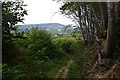
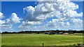

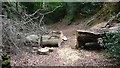

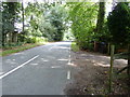
21 photos from this area
Area Information
Key information about the GU29 0BH including its size, population, and administrative classification.
- Area Type
- Postcode
- Area Size
- 1.5 km²
- Population
- 1588
- Population Density
- 240 people/km²
House Prices in GU29 0BH
15
Properties
£1,249,250
Average Sold Price
£630,000
Lowest Price
£1,950,000
Highest Price
Showing 15 properties
| Address | Type | Beds | Baths | Last Sale Price | Last Sale Date | |
|---|---|---|---|---|---|---|
| West Heath House, Kings Drive, Easebourne, GU29 0BH | house | 3 | - | £1,400,000 | Jun 2021 | |
| Ridgemoor, Kings Drive, Easebourne, GU29 0BH | Detached | 5 | 2 | £1,275,000 | Dec 2018 | |
| Pipit Wood, Kings Drive, Easebourne, GU29 0BH | house | - | - | £1,950,000 | Nov 2017 | |
| Southwood, Kings Drive, Easebourne, GU29 0BH | Detached | - | - | £695,000 | Dec 2016 | |
| Kingsbrier, Kings Drive, Easebourne, GU29 0BH | house | - | - | £1,950,000 | Jan 2016 | |
| Sarsgrove, Kings Drive, Easebourne, GU29 0BH | Detached | 5 | 4 | £1,850,000 | Sep 2015 | |
| Walnut Tree House, Kings Drive, Easebourne, GU29 0BH | Detached | 6 | 4 | £1,342,500 | Aug 2014 | |
| West Heath Cottage, Kings Drive, Easebourne, GU29 0BH | Detached | 4 | - | £650,000 | Aug 2013 | |
| Berrington, Kings Drive, Easebourne, GU29 0BH | Detached | - | - | £750,000 | Jan 2006 | |
| Stoney Warren, Kings Drive, Easebourne, GU29 0BH | Detached | - | - | £630,000 | Sep 2003 |
Page 1 of 2
Energy Efficiency in GU29 0BH
Amenities
Schools
| Rank | School | Type | Entry gender | Ages |
|---|
Explore more schools in this area
Go to Schools tabDemographics
Household Size
Two person
most common
Accommodation Type
Houses
most common
Tenure
72
majority
Ethnic Group
White
most common
Religion
N/A
most common
Household Composition
N/A
most common
Age
47
median
Adults (30-64 years)
most common
Household Deprivation
N/A
with no deprivation
NS-SEC
45
in Lower managerial occupations
Explore more demographic insights in this area
Go to Demographics tabPlanning
Planning Constraints
- Flood RiskPremium
- Ramsar Wetland SitesPremium
- Area of Outstanding Natural BeautyPremium
- Protected Nature ReservePremium
- Protected WoodlandPremium