Area Overview for GU28 9LP
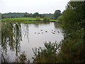
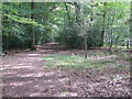
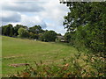
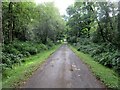
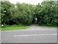
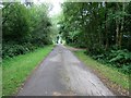
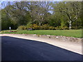
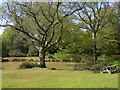
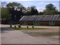
Photos of GU28 9LP


Area Information
GU28 9LP is a small residential postcode area in England, spanning 5.5 hectares and home to 1,599 residents. With a population density of just 40 people per square kilometre, it is a low-density, tightly knit community. The area’s character is defined by its modest size and the predominance of owner-occupied homes, with 60% of properties owned by residents. The median age of 47 suggests a mature demographic, with adults aged 30–64 forming the largest group. This reflects a settled, family-oriented environment where stability and community ties are likely strong. The area’s proximity to Petworth and Midhurst offers access to nearby amenities, while its low population density ensures a quiet, uncluttered lifestyle. For those seeking a peaceful, low-traffic residential setting with a balance of convenience and tranquillity, GU28 9LP provides a compact, self-contained environment.
- Area Type
- Postcode
- Area Size
- 5.5 hectares
- Population
- 1599
- Population Density
- 40 people/km²
The property market in GU28 9LP is characterised by a 60% home ownership rate, suggesting a strong presence of owner-occupied properties. The accommodation type is primarily houses, which is typical of smaller, low-density areas where larger homes are more common. This indicates a market that may appeal to families or individuals seeking spacious, private living. Given the area’s small size, the housing stock is likely limited, meaning buyers may need to consider nearby postcode areas for additional options. The predominance of owner-occupied homes suggests a stable market with fewer rental properties, potentially offering long-term value for those looking to settle in the area. However, the limited size of GU28 9LP itself means that property availability is constrained, requiring careful consideration of surrounding regions for broader choices.
House Prices in GU28 9LP
Showing 4 properties
| Address | Type | Beds | Baths | Last Sale Price | Last Sale Date | |
|---|---|---|---|---|---|---|
| 17 Colhook Industrial Park, Ebernoe, GU28 9LP | Industrial | - | - | - | - | |
| Hardware Associates Limited, 5-6 Colhook Industrial Park, Ebernoe, GU28 9LP | Industrial | - | - | - | - | |
| 2-3 Colhook Industrial Park, Ebernoe, GU28 9LP | Industrial | - | - | - | - | |
| Old Stables, Colhook Industrial Park, Ebernoe, GU28 9LP | Industrial | - | - | - | - |
Energy Efficiency in GU28 9LP
The lifestyle in GU28 9LP is shaped by its proximity to practical amenities. Nearby retail options include Spar, Co-op Petworth, and M&S Midhurst BP, providing essential shopping and fueling needs. The Haslemere Railway Station adds convenience for travel beyond the immediate area. While the data does not specify parks or leisure facilities, the low population density suggests potential for green spaces or natural surroundings. The combination of local shops and rail access supports a self-sufficient, low-stress lifestyle. Residents benefit from a balance of convenience and tranquillity, with amenities focused on daily essentials rather than expansive leisure options.
Amenities
Schools
Residents of GU28 9LP have access to two primary schools within practical reach. Petworth Cof E Primary School, rated ‘good’ by Ofsted, provides a solid foundation for young learners, while Herbert Shiner School offers another primary option. Both institutions cater to the needs of local families, ensuring children have access to education without long commutes. The presence of two primary schools suggests a focus on early education, though secondary schooling options would require travel to nearby towns. For families prioritising proximity to schools, the availability of two primary institutions is a significant advantage, supporting a community-oriented approach to education.
| Rank | School | Type | Entry gender | Ages |
|---|
Explore more schools in this area
Go to Schools tabDemographics
The community in GU28 9LP is predominantly composed of adults aged 30–64, with a median age of 47. This suggests a population that is largely established in careers and family life, with fewer young children or elderly residents. Home ownership is high at 60%, indicating a stable housing market where most residents are long-term occupants. The accommodation type is primarily houses, reflecting a suburban or semi-rural setting rather than high-density housing. The predominant ethnic group is White, though specific data on diversity is not provided. The low population density of 40 people per square kilometre implies spacious living conditions and potentially limited social density. For those prioritising a quiet, mature community with a focus on family stability, this area aligns with such preferences.
Household Size
Accommodation Type
Tenure
Ethnic Group
Religion
Household Composition
Age
Household Deprivation
NS-SEC
Explore more demographic insights in this area
Go to Demographics tabPlanning
Planning Constraints
- Flood RiskPremium
- Ramsar Wetland SitesPremium
- Area of Outstanding Natural BeautyPremium
- Protected Nature ReservePremium
- Protected WoodlandPremium