Area Overview for GU28 9DN
Photos of GU28 9DN
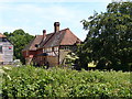
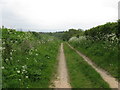
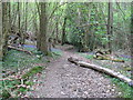
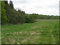
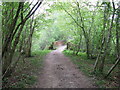
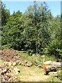
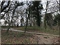
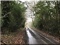
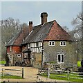

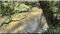
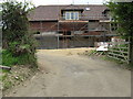
23 photos from this area
Area Information
Key information about the GU28 9DN including its size, population, and administrative classification.
- Area Type
- Postcode
- Area Size
- 71.8 hectares
- Population
- 1048
- Population Density
- 44 people/km²
House Prices in GU28 9DN
11
Properties
£1,119,400
Average Sold Price
£272,000
Lowest Price
£3,100,000
Highest Price
Showing 11 properties
| Address | Type | Beds | Baths | Last Sale Price | Last Sale Date | |
|---|---|---|---|---|---|---|
| 3, Leggatt Hill, River Lane, River, Lodsworth, GU28 9DN | Detached | 2 | 1 | £675,000 | Jul 2024 | |
| Smithbrook Hill, Surrey Road, Lodsworth, GU28 9DN | Detached | 4 | 3 | £1,250,000 | Apr 2023 | |
| Leggatt Hill Barn, River Lane, River, Lodsworth, GU28 9DN | Detached | 5 | 3 | £3,100,000 | Aug 2017 | |
| 2, Leggatt Hill, River Lane, River, Lodsworth, GU28 9DN | Semi-detached | - | - | £272,000 | Oct 2007 | |
| Keets, River Lane, River, Lodsworth, GU28 9DN | Detached | - | - | £300,000 | Jul 1997 | |
| Leggatt Hill Farmhouse, River Lane, River, Lodsworth, GU28 9DN | house | - | - | - | - | |
| Swallows, Leggatt Hill, River Lane, River, Lodsworth, GU28 9DN | Detached | - | - | - | - | |
| Lod House, River Lane, River, Lodsworth, GU28 9DN | house | - | - | - | - | |
| Little Leggatt Hill, River Lane, River, Lodsworth, GU28 9DN | house | - | - | - | - | |
| Redlands Farm, Surrey Road, Lodsworth, GU28 9DN | Farm | - | - | - | - |
Page 1 of 2
Energy Efficiency in GU28 9DN
Amenities
Schools
| Rank | School | Type | Entry gender | Ages |
|---|
Explore more schools in this area
Go to Schools tabDemographics
Household Size
Two person
most common
Accommodation Type
Houses
most common
Tenure
57
majority
Ethnic Group
White
most common
Religion
N/A
most common
Household Composition
N/A
most common
Age
47
median
Adults (30-64 years)
most common
Household Deprivation
N/A
with no deprivation
NS-SEC
41
in Lower managerial occupations
Explore more demographic insights in this area
Go to Demographics tabPlanning
Planning Constraints
- Flood RiskPremium
- Ramsar Wetland SitesPremium
- Area of Outstanding Natural BeautyPremium
- Protected Nature ReservePremium
- Protected WoodlandPremium