Area Overview for GU28 0RD
Photos of GU28 0RD
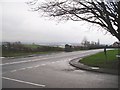
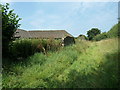
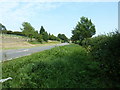
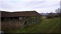
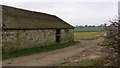
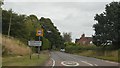
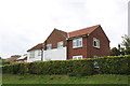
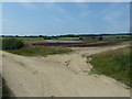
17 photos from this area
Area Information
Key information about the GU28 0RD including its size, population, and administrative classification.
- Area Type
- Postcode
- Area Size
- 66.8 hectares
- Population
- 1505
- Population Density
- 58 people/km²
House Prices in GU28 0RD
12
Properties
£392,500
Average Sold Price
£225,000
Lowest Price
£725,000
Highest Price
Showing 12 properties
| Address | Type | Beds | Baths | Last Sale Price | Last Sale Date | |
|---|---|---|---|---|---|---|
| Cradlers Barn, Willetts Lane, Upperton, Tillington, GU28 0RD | Detached | - | - | £725,000 | Jan 2004 | |
| Willetts House, A 272 New Road To The Harrows, Tillington, GU28 0RD | Detached | - | - | £225,000 | Feb 1997 | |
| The Black Barn, A 272 New Road To The Harrows, Tillington, GU28 0RD | Detached | - | - | £227,500 | Nov 1996 | |
| Hamfelde, A 272 New Road To The Harrows, Tillington, GU28 0RD | Bungalow | 4 | - | - | - | |
| 1, Willetts Field, A 272 New Road To The Harrows, Tillington, GU28 0RD | house | 4 | - | - | - | |
| Annexe, Upperton Farm, Willetts Lane, Upperton, Tillington, GU28 0RD | Detached | - | - | - | - | |
| Upperton Farm, Willetts Lane, Upperton, Tillington, GU28 0RD | Office | - | - | - | - | |
| 4, Willetts Field, A 272 New Road To The Harrows, Tillington, GU28 0RD | house | - | - | - | - | |
| 3, Willetts Field, A 272 New Road To The Harrows, Tillington, GU28 0RD | Semi-detached | - | - | - | - | |
| Little Common Farm, A 272 New Road To The Harrows, Tillington, GU28 0RD | Farm | - | - | - | - |
Page 1 of 2
Energy Efficiency in GU28 0RD
Amenities
Schools
| Rank | School | Type | Entry gender | Ages |
|---|
Explore more schools in this area
Go to Schools tabDemographics
Household Size
Two person
most common
Accommodation Type
Houses
most common
Tenure
71
majority
Ethnic Group
White
most common
Religion
N/A
most common
Household Composition
N/A
most common
Age
47
median
Adults (30-64 years)
most common
Household Deprivation
N/A
with no deprivation
NS-SEC
44
in Lower managerial occupations
Explore more demographic insights in this area
Go to Demographics tabPlanning
Planning Constraints
- Flood RiskPremium
- Ramsar Wetland SitesPremium
- Area of Outstanding Natural BeautyPremium
- Protected Nature ReservePremium
- Protected WoodlandPremium