Area Overview for GU28 0QF
Photos of GU28 0QF
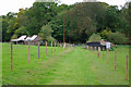
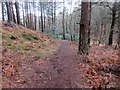
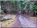
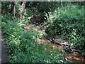
22 photos from this area
Area Information
Key information about the GU28 0QF including its size, population, and administrative classification.
- Area Type
- Postcode
- Area Size
- 78.3 hectares
- Population
- 1295
- Population Density
- 47 people/km²
House Prices in GU28 0QF
24
Properties
£532,700
Average Sold Price
£178,500
Lowest Price
£850,000
Highest Price
Showing 24 properties
| Address | Type | Beds | Baths | Last Sale Price | Last Sale Date | |
|---|---|---|---|---|---|---|
| Popple Hill Cottage, Graffham Road, East Lavington, GU28 0QF | Detached | 4 | - | £850,000 | Nov 2013 | |
| Popple Meadows, Graffham Road, East Lavington, GU28 0QF | house | - | - | £730,000 | Mar 2005 | |
| Cottage Eastwood Farm, Graffham Road, East Lavington, GU28 0QF | Detached | 8 | 3 | £685,000 | Jan 2000 | |
| Parsley Cottage, Graffham Road, East Lavington, GU28 0QF | Detached | - | - | £178,500 | Apr 1998 | |
| Grove Cottage, Graffham Road, East Lavington, GU28 0QF | Detached | - | - | £220,000 | Mar 1995 | |
| Denham, Graffham Road, East Lavington, GU28 0QF | Detached | 5 | 4 | - | - | |
| Northwood Farm, Graffham Road, East Lavington, GU28 0QF | house | 6 | - | - | - | |
| Pandora, Graffham Road, East Lavington, GU28 0QF | Bungalow | 2 | 2 | - | - | |
| Chapel Cottage, Graffham Road, East Lavington, GU28 0QF | Detached | - | - | - | - | |
| Pottery Cottage, Graffham Road, East Lavington, GU28 0QF | Bungalow | 1 | 1 | - | - |
Page 1 of 3
Energy Efficiency in GU28 0QF
Amenities
Schools
| Rank | School | Type | Entry gender | Ages |
|---|
Explore more schools in this area
Go to Schools tabDemographics
Household Size
Two person
most common
Accommodation Type
Houses
most common
Tenure
73
majority
Ethnic Group
White
most common
Religion
N/A
most common
Household Composition
N/A
most common
Age
47
median
Adults (30-64 years)
most common
Household Deprivation
N/A
with no deprivation
NS-SEC
43
in Lower managerial occupations
Explore more demographic insights in this area
Go to Demographics tabPlanning
Planning Constraints
- Flood RiskPremium
- Ramsar Wetland SitesPremium
- Area of Outstanding Natural BeautyPremium
- Protected Nature ReservePremium
- Protected WoodlandPremium