Area Overview for GU28 0NB
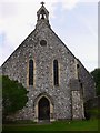
Photos of GU28 0NB


Area Information
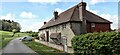
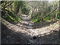
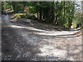
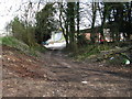
Living in GU28 0NB offers a quiet, residential experience in a small cluster of homes spread across 8,096 square metres. With a population of 1,295, the area has a low density of 47 people per square kilometre, reflecting its semi-rural character. This postcode is ideal for those seeking a peaceful, community-focused environment without the bustle of larger towns. The area’s proximity to nearby villages and amenities ensures a balance between seclusion and accessibility. Daily life here is shaped by its modest size—residents are likely to know their neighbours, with local shops and transport links providing essentials. The low crime risk score of 88/100 and absence of environmental constraints like protected woodlands or wetlands make it a practical choice for families and retirees. While not a commercial hub, GU28 0NB’s charm lies in its simplicity, with homes set in a landscape free from major planning restrictions. For buyers prioritising safety, space, and a low-maintenance lifestyle, this area presents a straightforward, uncluttered living option.
- Area Type
- Postcode
- Area Size
- 8096 m²
- Population
- 1295
- Population Density
- 47 people/km²
The property market in GU28 0NB is dominated by owner-occupied homes, with 73% of residents owning their properties. This high home ownership rate suggests a stable, long-term community with limited rental activity. The accommodation types are primarily houses, indicating a focus on family homes or single-person residences with more space than flats. In such a small area, the housing stock is likely to be limited in quantity, meaning properties may retain value due to low supply. For buyers, this means a market where competition is minimal, but opportunities to purchase are also constrained. The absence of major planning restrictions or environmental constraints makes the area attractive for those seeking a straightforward purchase without legal complexities. However, the small size of the postcode means that buyers should consider nearby areas for a broader selection of properties. The emphasis on houses also implies that the area may not suit those prioritising rental income or smaller living spaces.
House Prices in GU28 0NB
Showing 27 properties
Energy Efficiency in GU28 0NB
The lifestyle in GU28 0NB is defined by its proximity to essential retail and transport hubs. Nearby shops include Co-op Petworth, Spar, and Sainsburys Midhurst, providing access to groceries, household goods, and daily necessities. These stores are within practical reach, reducing the need for long trips to larger centres. The area’s two railway stations—Amberley and Pulborough—connect residents to broader networks, facilitating travel to nearby towns for leisure, work, or shopping. While the postcode itself has no major parks or leisure facilities, its location near rural landscapes and nearby villages offers opportunities for outdoor activities. The character of the area is one of convenience and simplicity, with amenities tailored to a small, close-knit community. Residents can enjoy a relaxed pace of life, with local shops and transport links ensuring that daily needs are met without the complexity of urban environments.
Amenities
Schools
GU28 0NB is served by a mix of primary and independent schools, offering options for families at different stages of education. Graffham CofE Infant School and Graffham Church of England Infant School (Voluntary Controlled) both provide primary education, with the latter holding a Good Ofsted rating. Duncton CofE Junior School, also a primary school, shares the same Good rating, ensuring quality education for younger children. For older students or those seeking independent education, Seaford College and St Michael’s Burton Park are nearby, catering to those preferring non-state-funded schooling. This combination of state and independent schools allows families to choose between free public education and private alternatives. The presence of two primary schools with strong ratings is a significant advantage, reducing the need for long commutes. However, the area lacks secondary schools, meaning students may need to travel to nearby towns for further education.
| Rank | School | Type | Entry gender | Ages |
|---|
Explore more schools in this area
Go to Schools tabDemographics
The community in GU28 0NB is predominantly composed of adults aged 30–64, with a median age of 47. This suggests a mature, stable population, likely including families and professionals settled in the area. Home ownership is high at 73%, indicating a strong presence of long-term residents. The accommodation types are primarily houses, reflecting a preference for detached or semi-detached properties over flats. The predominant ethnic group is White, aligning with broader trends in rural England. With no data on deprivation levels, the area’s quality of life appears supported by its low crime risk and lack of environmental constraints. The demographic profile suggests a community focused on stability, with limited turnover of residents. This makes GU28 0NB a predictable, low-stress environment, though it may lack the diversity of larger urban areas. The age range also implies a demand for schools and healthcare services that cater to families and older adults.
Household Size
Accommodation Type
Tenure
Ethnic Group
Religion
Household Composition
Age
Household Deprivation
NS-SEC
Explore more demographic insights in this area
Go to Demographics tabPlanning
Planning Constraints
- Flood RiskPremium
- Ramsar Wetland SitesPremium
- Area of Outstanding Natural BeautyPremium
- Protected Nature ReservePremium
- Protected WoodlandPremium