Area Overview for GU28 0HA
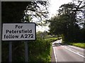
Photos of GU28 0HA


Area Information
GU28 0HA is a small residential postcode area in England, covering 1,894 square metres and home to 1,695 residents. Its compact size means it is a tightly knit community, with a population density of 572 people per square kilometre. This area is characterised by its low environmental risks, including no flood zones, protected woodlands, or natural beauty sites. The demographic profile suggests a mature population, with a median age of 47 and the majority of residents aged between 30 and 64. Daily life here is likely to revolve around local amenities, with nearby shops such as Co-op Petworth and Tesco Pulborough providing essential services. The area’s proximity to Pulborough Railway Station adds connectivity to nearby towns. While broadband quality is poor, mobile coverage is strong, supporting communication and remote work. The low crime score of 82/100 indicates a safe environment, though the area’s small size means it is not a hub for large-scale retail or entertainment. For those seeking a quiet, low-risk neighbourhood with a practical balance of local services and transport links, GU28 0HA offers a distinct blend of residential simplicity and accessibility.
- Area Type
- Postcode
- Area Size
- 1894 m²
- Population
- 1695
- Population Density
- 572 people/km²
The property market in GU28 0HA is shaped by its 47% home ownership rate, which suggests that nearly half of the housing stock is rented out. The accommodation type is predominantly houses, indicating a focus on single-family homes rather than apartments or flats. This makes the area more suitable for families or individuals seeking larger living spaces, though the small size of the postcode means the overall housing stock is limited. With a population of 1,695 spread across 1,894 square metres, property availability is likely constrained, potentially leading to competitive conditions for buyers. The low crime risk and absence of environmental restrictions may appeal to those prioritising safety and stability. However, the broadband score of 27, which is poor, could be a drawback for remote workers. For buyers, this area may represent a niche opportunity to purchase a house in a low-risk, family-oriented setting, though the limited size of the area means proximity to larger towns or cities is essential for broader amenities.
House Prices in GU28 0HA
Showing 3 properties
| Address | Type | Beds | Baths | Last Sale Price | Last Sale Date | |
|---|---|---|---|---|---|---|
| 292B Horsham Road, Petworth, GU28 0HA | Terraced | 4 | 2 | - | - | |
| 292D Horsham Road, Petworth, GU28 0HA | house | - | - | - | - | |
| 292C Horsham Road, Petworth, GU28 0HA | house | - | - | - | - |
Energy Efficiency in GU28 0HA
Living in GU28 0HA offers access to essential retail and transport services within a short distance. Nearby shops include Co-op Petworth, Spar, and Tesco Pulborough, providing daily necessities such as groceries and household items. These stores suggest a practical, localised shopping experience, though the absence of larger retail chains or dining options may require trips to nearby towns. The area’s proximity to Pulborough Railway Station enhances mobility, connecting residents to broader networks for work, leisure, or socialising. While there is no mention of parks or leisure facilities in the data, the low environmental risk and lack of protected areas imply a landscape that is not heavily regulated, potentially offering open spaces for recreation. The character of daily life here is likely defined by convenience and simplicity, with a focus on local services and the railway as a key link to external opportunities.
Amenities
Schools
| Rank | School | Type | Entry gender | Ages |
|---|
Explore more schools in this area
Go to Schools tabDemographics
The community in GU28 0HA is predominantly composed of adults aged 30 to 64, with a median age of 47. This suggests a population skewed towards middle-aged individuals, likely including families and professionals in stable careers. Home ownership stands at 47%, which is slightly below the national average, indicating that a significant portion of the housing stock is rented out. The accommodation type is primarily houses, which may reflect a preference for family homes or larger properties. The predominant ethnic group is White, though no specific data on diversity or deprivation levels is provided. The low population density of 572 people per square kilometre implies a spread-out residential layout, possibly with larger plots of land per household. This demographic profile suggests a community that values stability and privacy, with limited reliance on public transport or dense urban infrastructure. The age range and home ownership figures also hint at a potential demand for rental properties, particularly for younger professionals or families seeking affordable housing in a low-risk area.
Household Size
Accommodation Type
Tenure
Ethnic Group
Religion
Household Composition
Age
Household Deprivation
NS-SEC
Explore more demographic insights in this area
Go to Demographics tabPlanning
Planning Constraints
- Flood RiskPremium
- Ramsar Wetland SitesPremium
- Area of Outstanding Natural BeautyPremium
- Protected Nature ReservePremium
- Protected WoodlandPremium