Area Overview for GU28 0FB
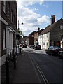
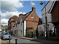
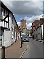
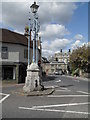
Photos of GU28 0FB
Area Information
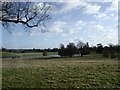
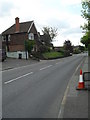
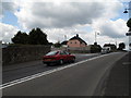
GU28 0FB is a small, tightly knit residential postcode in England, covering 3,080 square metres and home to 1,599 residents. With a population density of just 40 people per square kilometre, it offers a quiet, rural feel typical of its location. The area’s compact size means it is likely centred around a small cluster of homes, possibly near Pulborough or Petworth, given the nearby amenities. Daily life here is likely characterised by a slower pace, with residents relying on nearby towns for shopping, transport, and services. The demographic profile suggests a mature community, with a median age of 47 and a majority of residents aged 30–64. This hints at a stable, family-oriented environment, though the area’s small size means it is not a hub for nightlife or large-scale commercial activity. For those seeking a peaceful, low-density living space with easy access to nearby towns, GU28 0FB could be appealing. Its limited scale also means it is not a high-traffic area, which may be a draw for buyers prioritising tranquillity over urban convenience.
- Area Type
- Postcode
- Area Size
- 3080 m²
- Population
- 1599
- Population Density
- 40 people/km²
The property market in GU28 0FB is defined by a 60% home ownership rate, with houses making up the majority of accommodation types. This suggests a focus on family homes rather than high-density housing, which is typical of rural or semi-rural areas. The relatively small area size of 3,080 square metres implies limited land availability, potentially restricting new developments. For buyers, this means the market is likely characterised by existing properties rather than new builds. The 60% ownership rate also indicates a mix of private and rental properties, though the proportion of renters is not explicitly stated. Given the area’s size, property values may be influenced more by location factors—such as proximity to Pulborough or Petworth—than by local amenities. Buyers should consider the limited scope for expansion and the potential for a stable, long-term investment in a low-density housing stock.
House Prices in GU28 0FB
Showing 5 properties
| Address | Type | Beds | Baths | Last Sale Price | Last Sale Date | |
|---|---|---|---|---|---|---|
| 5 Courthouse Close, Petworth, GU28 0FB | house | - | - | £625,000 | Oct 2022 | |
| 4 Courthouse Close, Petworth, GU28 0FB | house | - | - | £575,000 | Sep 2021 | |
| 1 Courthouse Close, Petworth, GU28 0FB | house | - | - | £530,000 | Jun 2015 | |
| 2 Courthouse Close, Petworth, GU28 0FB | house | - | - | £500,000 | Jun 2015 | |
| 3 Courthouse Close, Petworth, GU28 0FB | house | - | - | £500,000 | Jun 2015 |
Energy Efficiency in GU28 0FB
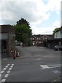
Residents of GU28 0FB have access to a modest range of amenities within practical reach. The area includes five retail outlets, notably Co-op Petworth, Tesco Pulborough, and Spar, providing everyday shopping and convenience services. These stores suggest a basic level of retail infrastructure, suitable for routine purchases but not extensive shopping experiences. The nearby Pulborough Railway Station adds connectivity, allowing residents to travel to larger towns for more specialised services. While the data does not mention parks or leisure facilities, the low population density and lack of planning constraints suggest space for informal outdoor activities. The combination of local shops and rail access creates a lifestyle that balances self-sufficiency with the ability to access broader opportunities. This makes GU28 0FB appealing to those prioritising simplicity and proximity to nearby towns.
Amenities
Schools
GU28 0FB is served by two primary schools: Petworth Cof E Primary School, which holds an Ofsted rating of 'good', and Herbert Shiner School. Both institutions cater to younger children, making the area suitable for families with primary-aged children. The presence of two primary schools suggests a reasonable spread of educational options, though no secondary schools are listed in the data. The 'good' rating at Petworth Cof E Primary indicates a school that meets or exceeds national standards in teaching and outcomes. For families prioritising education, this mix of schools provides a foundation for early learning. However, the lack of secondary school data means prospective buyers may need to look further afield for secondary education. The availability of two primary schools is a key consideration for those planning to settle in the area with young children.
| Rank | School | Type | Entry gender | Ages |
|---|
Explore more schools in this area
Go to Schools tabDemographics
The community in GU28 0FB is predominantly composed of adults aged 30–64, with a median age of 47. This suggests a mature, possibly retired or established working-age population. Home ownership is at 60%, indicating a mix of owner-occupied properties and rental units, though the exact balance is not specified. The area is characterised by houses rather than flats or apartments, which aligns with its likely rural or semi-rural setting. The predominant ethnic group is White, though no further breakdown of diversity is provided. With a population of 1,599, the area is small enough to foster a close-knit community but not so large as to feel anonymous. The low population density of 40 people per square kilometre reinforces the area’s sparse, possibly suburban or village-like character. These figures suggest a stable, long-term resident base, though the data does not indicate whether the area is growing or shrinking.
Household Size
Accommodation Type
Tenure
Ethnic Group
Religion
Household Composition
Age
Household Deprivation
NS-SEC
Explore more demographic insights in this area
Go to Demographics tabPlanning
Planning Constraints
- Flood RiskPremium
- Ramsar Wetland SitesPremium
- Area of Outstanding Natural BeautyPremium
- Protected Nature ReservePremium
- Protected WoodlandPremium