Area Overview for GU28 0ED
Photos of GU28 0ED
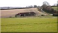
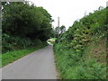
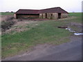
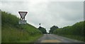
19 photos from this area
Area Information
Key information about the GU28 0ED including its size, population, and administrative classification.
- Area Type
- Postcode
- Area Size
- 15.7 hectares
- Population
- 1599
- Population Density
- 40 people/km²
House Prices in GU28 0ED
20
Properties
£216,056
Average Sold Price
£57,500
Lowest Price
£421,500
Highest Price
Showing 20 properties
| Address | Type | Beds | Baths | Last Sale Price | Last Sale Date | |
|---|---|---|---|---|---|---|
| 3 South Grove, Petworth, GU28 0ED | Semi-detached | 4 | 2 | £421,500 | Sep 2024 | |
| 14 South Grove, Petworth, GU28 0ED | Retail | 4 | 2 | £370,000 | Apr 2022 | |
| Olivers Cottage, South Grove, Petworth, GU28 0ED | house | 2 | 1 | £325,000 | Jan 2018 | |
| 9 South Grove, Petworth, GU28 0ED | Semi-detached | 3 | - | £250,000 | Dec 2013 | |
| 15 South Grove, Petworth, GU28 0ED | Semi-detached | - | - | £210,000 | Nov 2006 | |
| 5 South Grove, Petworth, GU28 0ED | Semi-detached | - | - | £167,000 | Feb 2003 | |
| 7 South Grove, Petworth, GU28 0ED | Semi-detached | - | - | £59,000 | Dec 2001 | |
| 2 South Grove, Petworth, GU28 0ED | Semi-detached | - | - | £57,500 | Oct 2000 | |
| 12 South Grove, Petworth, GU28 0ED | Semi-detached | - | - | £84,500 | Jun 1998 | |
| New House, South Grove, Petworth, GU28 0ED | Detached | 3 | 2 | - | - |
Page 1 of 2
Energy Efficiency in GU28 0ED
Amenities
Schools
| Rank | School | Type | Entry gender | Ages |
|---|
Explore more schools in this area
Go to Schools tabDemographics
Household Size
Two person
most common
Accommodation Type
Houses
most common
Tenure
60
majority
Ethnic Group
White
most common
Religion
N/A
most common
Household Composition
N/A
most common
Age
47
median
Adults (30-64 years)
most common
Household Deprivation
N/A
with no deprivation
NS-SEC
38
in Lower managerial occupations
Explore more demographic insights in this area
Go to Demographics tabPlanning
Planning Constraints
- Flood RiskPremium
- Ramsar Wetland SitesPremium
- Area of Outstanding Natural BeautyPremium
- Protected Nature ReservePremium
- Protected WoodlandPremium