Area Overview for GU27 3DX
Photos of GU27 3DX
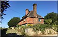
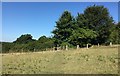
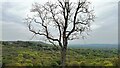
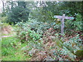
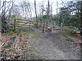
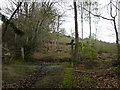
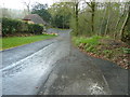
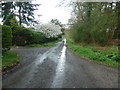
30 photos from this area
Area Information
Key information about the GU27 3DX including its size, population, and administrative classification.
- Area Type
- Postcode
- Area Size
- 23.5 hectares
- Population
- 2117
- Population Density
- 121 people/km²
House Prices in GU27 3DX
17
Properties
£742,429
Average Sold Price
£135,000
Lowest Price
£1,100,000
Highest Price
Showing 17 properties
| Address | Type | Beds | Baths | Last Sale Price | Last Sale Date | |
|---|---|---|---|---|---|---|
| Cedar Cottage, Fridays Hill, Fernhurst, GU27 3DX | Detached | 4 | 2 | £985,000 | Dec 2019 | |
| Aurian Wood, Fridays Hill, Fernhurst, GU27 3DX | house | - | - | £1,100,000 | Dec 2018 | |
| New Pond, Fridays Hill, Fernhurst, GU27 3DX | house | - | - | £1,088,000 | Oct 2016 | |
| Leigh House, Fridays Hill, Fernhurst, GU27 3DX | house | 4 | - | £1,000,000 | Sep 2012 | |
| Highlands, Fridays Hill, Fernhurst, GU27 3DX | Detached | 6 | 4 | £525,000 | Jun 2011 | |
| Hambledon, Fridays Hill, Fernhurst, GU27 3DX | Detached | - | - | £364,000 | Nov 1998 | |
| Reek Reynolds, Fridays Hill, Fernhurst, GU27 3DX | house | - | - | £135,000 | Jun 1998 | |
| Fridays Hill House, Fridays Hill, Fernhurst, GU27 3DX | Detached | 4 | 4 | - | - | |
| Fernshaw House, Fridays Hill, Fernhurst, GU27 3DX | Detached | 6 | - | - | - | |
| Reeks Reynolds Cottage, Fridays Hill, Fernhurst, GU27 3DX | Bungalow | 3 | 1 | - | - |
Page 1 of 2
Energy Efficiency in GU27 3DX
Amenities
Schools
| Rank | School | Type | Entry gender | Ages |
|---|
Explore more schools in this area
Go to Schools tabDemographics
Household Size
Two person
most common
Accommodation Type
Houses
most common
Tenure
69
majority
Ethnic Group
White
most common
Religion
N/A
most common
Household Composition
N/A
most common
Age
47
median
Adults (30-64 years)
most common
Household Deprivation
N/A
with no deprivation
NS-SEC
41
in Lower managerial occupations
Explore more demographic insights in this area
Go to Demographics tabPlanning
Planning Constraints
- Flood RiskPremium
- Ramsar Wetland SitesPremium
- Area of Outstanding Natural BeautyPremium
- Protected Nature ReservePremium
- Protected WoodlandPremium