Area Overview for GU27 3BX
Photos of GU27 3BX
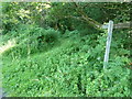
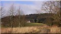
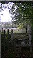
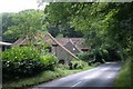
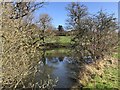
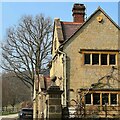
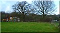
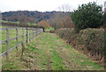
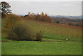
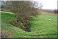
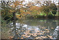
59 photos from this area
Area Information
Key information about the GU27 3BX including its size, population, and administrative classification.
- Area Type
- Postcode
- Area Size
- 56.0 hectares
- Population
- 1401
- Population Density
- 41 people/km²
House Prices in GU27 3BX
14
Properties
£670,495
Average Sold Price
£262,477
Lowest Price
£975,000
Highest Price
Showing 14 properties
| Address | Type | Beds | Baths | Last Sale Price | Last Sale Date | |
|---|---|---|---|---|---|---|
| Sybs Farm, Jobsons Lane, Windfall Wood Common, Lurgashall, GU27 3BX | house | - | - | £975,000 | Mar 2020 | |
| The Lodge, Jobsons Lane, Windfall Wood Common, Lurgashall, GU27 3BX | house | - | - | £900,000 | Jan 2011 | |
| The Cottage, Jobsons Lane, Windfall Wood Common, Lurgashall, GU27 3BX | house | 3 | - | £695,000 | Nov 2010 | |
| Foresters, Jobsons Lane, Windfall Wood Common, Lurgashall, GU27 3BX | Bungalow | - | - | £520,000 | Dec 2000 | |
| Windfallwood Cottage, Jobsons Lane, Windfall Wood Common, Lurgashall, GU27 3BX | Detached | 4 | 5 | £262,477 | Dec 1998 | |
| Windfall Paddock, Jobsons Lane, Windfall Wood Common, Lurgashall, GU27 3BX | Detached | 5 | 5 | - | - | |
| Woodgers Croft, Jobsons Lane, Windfall Wood Common, Lurgashall, GU27 3BX | Detached | - | - | - | - | |
| Block 2, Windfallwood Cottage, Jobsons Lane, Windfall Wood Common, Lurgashall, GU27 3BX | Semi-detached | - | - | - | - | |
| Block 1, Windfallwood Cottage, Jobsons Lane, Windfall Wood Common, Lurgashall, GU27 3BX | Semi-detached | - | - | - | - | |
| Guardian Cottage, Jobsons Lane, Windfall Wood Common, Lurgashall, GU27 3BX | Detached | - | - | - | - |
Page 1 of 2
Energy Efficiency in GU27 3BX
Amenities
Schools
| Rank | School | Type | Entry gender | Ages |
|---|
Explore more schools in this area
Go to Schools tabDemographics
Household Size
Two person
most common
Accommodation Type
Houses
most common
Tenure
66
majority
Ethnic Group
White
most common
Religion
N/A
most common
Household Composition
N/A
most common
Age
47
median
Adults (30-64 years)
most common
Household Deprivation
N/A
with no deprivation
NS-SEC
40
in Lower managerial occupations
Explore more demographic insights in this area
Go to Demographics tabPlanning
Planning Constraints
- Flood RiskPremium
- Ramsar Wetland SitesPremium
- Area of Outstanding Natural BeautyPremium
- Protected Nature ReservePremium
- Protected WoodlandPremium