Area Overview for GU27 2LF
Photos of GU27 2LF
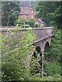
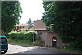
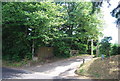
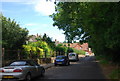
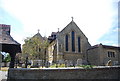
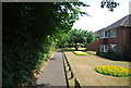
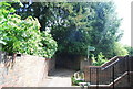
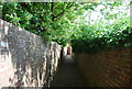
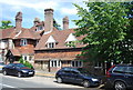
100 photos from this area
Area Information
Key information about the GU27 2LF including its size, population, and administrative classification.
- Area Type
- Postcode
- Area Size
- 3.9 hectares
- Population
- 1649
- Population Density
- 492 people/km²
House Prices in GU27 2LF
22
Properties
£1,015,594
Average Sold Price
£234,012
Lowest Price
£1,730,000
Highest Price
Showing 22 properties
| Address | Type | Beds | Baths | Last Sale Price | Last Sale Date | |
|---|---|---|---|---|---|---|
| Crossways, Kemnal Park, Haslemere, GU27 2LF | house | 4 | 3 | £1,543,334 | Nov 2023 | |
| Barnfields, Kemnal Park, Haslemere, GU27 2LF | Semi-detached | 5 | 4 | £1,730,000 | Jun 2021 | |
| Kingswood, Kemnal Park, Haslemere, GU27 2LF | Detached | 5 | 4 | £1,290,000 | May 2019 | |
| Chapter House, Kemnal Park, Haslemere, GU27 2LF | Detached | 5 | 4 | £1,350,000 | Dec 2018 | |
| Ashlands, 14 Kemnal Park, Haslemere, GU27 2LF | Detached | 3 | 1 | £890,000 | Nov 2014 | |
| 9 Kemnal Park, Haslemere, GU27 2LF | Detached | 6 | - | £990,000 | Oct 2011 | |
| 7 Kemnal Park, Haslemere, GU27 2LF | Detached | - | - | £750,000 | Dec 2006 | |
| Borrowdale, Kemnal Park, Haslemere, GU27 2LF | Bungalow | - | - | £363,000 | Apr 1999 | |
| 8 Kemnal Park, Haslemere, GU27 2LF | Detached | - | - | £234,012 | Aug 1997 | |
| 1 Kemnal Park, Haslemere, GU27 2LF | Detached | 4 | 3 | - | - |
Page 1 of 3
Energy Efficiency in GU27 2LF
Amenities
Schools
| Rank | School | Type | Entry gender | Ages |
|---|
Explore more schools in this area
Go to Schools tabDemographics
Household Size
Family (3-5 people)
most common
Accommodation Type
Houses
most common
Tenure
71
majority
Ethnic Group
White
most common
Religion
N/A
most common
Household Composition
N/A
most common
Age
47
median
Adults (30-64 years)
most common
Household Deprivation
N/A
with no deprivation
NS-SEC
47
in Lower managerial occupations
Explore more demographic insights in this area
Go to Demographics tabPlanning
Planning Constraints
- Flood RiskPremium
- Ramsar Wetland SitesPremium
- Area of Outstanding Natural BeautyPremium
- Protected Nature ReservePremium
- Protected WoodlandPremium