Area Overview for GU27 2JB
Photos of GU27 2JB
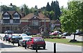
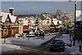
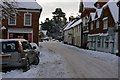
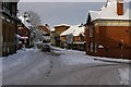
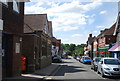
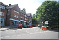
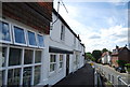
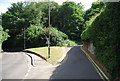
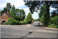
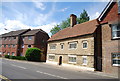
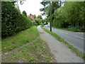
100 photos from this area
Area Information
Key information about the GU27 2JB including its size, population, and administrative classification.
- Area Type
- Postcode
- Area Size
- 5310 m²
- Population
- 1823
- Population Density
- 1340 people/km²
House Prices in GU27 2JB
18
Properties
£399,955
Average Sold Price
£41,500
Lowest Price
£950,000
Highest Price
Showing 18 properties
| Address | Type | Beds | Baths | Last Sale Price | Last Sale Date | |
|---|---|---|---|---|---|---|
| 25 Petworth Road, Haslemere, GU27 2JB | Terraced | 2 | 1 | £370,000 | Sep 2025 | |
| 23 Petworth Road, Haslemere, GU27 2JB | Terraced | 2 | 2 | £495,000 | Jun 2023 | |
| 27 Petworth Road, Haslemere, GU27 2JB | Terraced | 2 | 1 | £358,000 | Mar 2021 | |
| Springfort House, 9 Petworth Road, Haslemere, GU27 2JB | house | 3 | 1 | £827,500 | Apr 2016 | |
| East Garden, 29 Petworth Road, Haslemere, GU27 2JB | Detached | 4 | 2 | £950,000 | Oct 2015 | |
| 21 Petworth Road, Haslemere, GU27 2JB | Semi-detached | 3 | - | £540,000 | Apr 2015 | |
| 17 Petworth Road, Haslemere, GU27 2JB | Terraced | 3 | 2 | £41,500 | Jul 2014 | |
| 15A Petworth Road, Haslemere, GU27 2JB | Cottage | 3 | - | £210,000 | Apr 2008 | |
| 15 Petworth Road, Haslemere, GU27 2JB | Terraced | - | - | £210,000 | Apr 2008 | |
| 7A Petworth Road, Haslemere, GU27 2JB | Flat | 2 | 1 | £200,000 | Apr 2005 |
Page 1 of 2
Energy Efficiency in GU27 2JB
Amenities
Schools
| Rank | School | Type | Entry gender | Ages |
|---|
Explore more schools in this area
Go to Schools tabDemographics
Household Size
Two person
most common
Accommodation Type
Houses
most common
Tenure
62
majority
Ethnic Group
White
most common
Religion
N/A
most common
Household Composition
N/A
most common
Age
47
median
Adults (30-64 years)
most common
Household Deprivation
N/A
with no deprivation
NS-SEC
46
in Lower managerial occupations
Explore more demographic insights in this area
Go to Demographics tabPlanning
Planning Constraints
- Flood RiskPremium
- Ramsar Wetland SitesPremium
- Area of Outstanding Natural BeautyPremium
- Protected Nature ReservePremium
- Protected WoodlandPremium