Area Overview for GU27 1PQ
Photos of GU27 1PQ
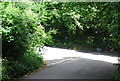
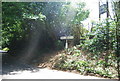
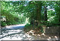
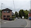
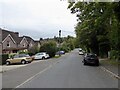
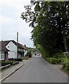
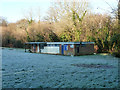
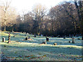
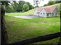
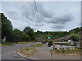

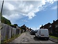
87 photos from this area
Area Information
Key information about the GU27 1PQ including its size, population, and administrative classification.
- Area Type
- Postcode
- Area Size
- 1.6 hectares
- Population
- 1298
- Population Density
- 3041 people/km²
House Prices in GU27 1PQ
24
Properties
£289,381
Average Sold Price
£79,200
Lowest Price
£599,950
Highest Price
Showing 24 properties
| Address | Type | Beds | Baths | Last Sale Price | Last Sale Date | |
|---|---|---|---|---|---|---|
| Acorns, Oak Tree Lane, Haslemere, GU27 1PQ | Detached | 3 | 2 | £599,950 | Dec 2025 | |
| Little Island, Oak Tree Lane, Haslemere, GU27 1PQ | Bungalow | 3 | 2 | £350,000 | Sep 2021 | |
| 24 Oak Tree Lane, Haslemere, GU27 1PQ | Semi-detached | 3 | 1 | £365,000 | Jun 2021 | |
| 20 Oak Tree Lane, Haslemere, GU27 1PQ | Detached | 3 | 1 | £440,000 | Jul 2017 | |
| 16 Oak Tree Lane, Haslemere, GU27 1PQ | house | 3 | - | £375,000 | Aug 2015 | |
| Lydcot, Oak Tree Lane, Haslemere, GU27 1PQ | Detached | - | - | £145,000 | Dec 2010 | |
| 14 Oak Tree Lane, Haslemere, GU27 1PQ | Detached | 3 | 1 | £295,000 | Dec 2010 | |
| 10 Oak Tree Lane, Haslemere, GU27 1PQ | house | - | - | £299,000 | Jun 2010 | |
| 18 Oak Tree Lane, Haslemere, GU27 1PQ | Detached | 4 | 2 | £270,000 | May 2007 | |
| Sunnymede, Oak Tree Lane, Haslemere, GU27 1PQ | Detached | - | - | £299,950 | Dec 2006 |
Page 1 of 3
Energy Efficiency in GU27 1PQ
Amenities
Schools
| Rank | School | Type | Entry gender | Ages |
|---|
Explore more schools in this area
Go to Schools tabDemographics
Household Size
Two person
most common
Accommodation Type
Houses
most common
Tenure
66
majority
Ethnic Group
White
most common
Religion
N/A
most common
Household Composition
N/A
most common
Age
47
median
Adults (30-64 years)
most common
Household Deprivation
N/A
with no deprivation
NS-SEC
36
in Lower managerial occupations
Explore more demographic insights in this area
Go to Demographics tabPlanning
Planning Constraints
- Flood RiskPremium
- Ramsar Wetland SitesPremium
- Area of Outstanding Natural BeautyPremium
- Protected Nature ReservePremium
- Protected WoodlandPremium