Area Overview for GU27 1NA
Photos of GU27 1NA
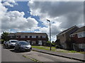
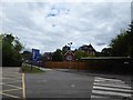
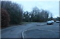
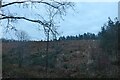
29 photos from this area
Area Information
Key information about the GU27 1NA including its size, population, and administrative classification.
- Area Type
- Postcode
- Area Size
- 1.2 hectares
- Population
- 1298
- Population Density
- 3041 people/km²
House Prices in GU27 1NA
43
Properties
£157,081
Average Sold Price
£39,950
Lowest Price
£350,000
Highest Price
Showing 43 properties
| Address | Type | Beds | Baths | Last Sale Price | Last Sale Date | |
|---|---|---|---|---|---|---|
| 33 Rackfield, Haslemere, GU27 1NA | Terraced | 3 | 1 | £350,000 | Aug 2024 | |
| 24 Rackfield, Haslemere, GU27 1NA | Flat | - | - | £225,000 | May 2020 | |
| 23 Rackfield, Haslemere, GU27 1NA | Flat | - | - | £220,000 | Jun 2019 | |
| 22 Rackfield, Haslemere, GU27 1NA | Flat | 2 | 1 | £161,000 | Dec 2007 | |
| 25 Rackfield, Haslemere, GU27 1NA | Flat | - | - | £56,200 | Aug 2007 | |
| 37 Rackfield, Haslemere, GU27 1NA | Flat | - | - | £133,500 | Feb 2006 | |
| 28 Rackfield, Haslemere, GU27 1NA | Terraced | - | - | £71,000 | Aug 1997 | |
| 20 Rackfield, Haslemere, GU27 1NA | Maisonette | - | - | £39,950 | Sep 1995 | |
| Flat Block 19 To 22, Rackfield, Haslemere, GU27 1NA | Unknown | - | - | - | - | |
| Flat Block 15 To 18, Rackfield, Haslemere, GU27 1NA | Unknown | - | - | - | - |
Page 1 of 5
Energy Efficiency in GU27 1NA
Amenities
Schools
| Rank | School | Type | Entry gender | Ages |
|---|
Explore more schools in this area
Go to Schools tabDemographics
Household Size
Two person
most common
Accommodation Type
Houses
most common
Tenure
66
majority
Ethnic Group
White
most common
Religion
N/A
most common
Household Composition
N/A
most common
Age
47
median
Adults (30-64 years)
most common
Household Deprivation
N/A
with no deprivation
NS-SEC
36
in Lower managerial occupations
Explore more demographic insights in this area
Go to Demographics tabPlanning
Planning Constraints
- Flood RiskPremium
- Ramsar Wetland SitesPremium
- Area of Outstanding Natural BeautyPremium
- Protected Nature ReservePremium
- Protected WoodlandPremium