Area Overview for GU27 1BS
Photos of GU27 1BS
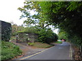
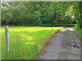
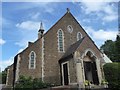
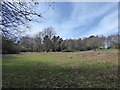
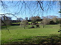
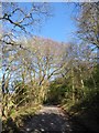
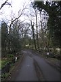
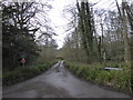
66 photos from this area
Area Information
Key information about the GU27 1BS including its size, population, and administrative classification.
- Area Type
- Postcode
- Area Size
- 5.1 hectares
- Population
- 1753
- Population Density
- 1296 people/km²
House Prices in GU27 1BS
16
Properties
£1,321,778
Average Sold Price
£535,000
Lowest Price
£1,825,000
Highest Price
Showing 16 properties
| Address | Type | Beds | Baths | Last Sale Price | Last Sale Date | |
|---|---|---|---|---|---|---|
| Derby House, Derby Road, Haslemere, GU27 1BS | house | 4 | 3 | £1,825,000 | Aug 2024 | |
| Uplands, 15 Derby Road, Haslemere, GU27 1BS | house | - | - | £1,550,000 | Mar 2021 | |
| 9 Derby Road, Haslemere, GU27 1BS | Detached | 4 | 3 | £1,600,000 | Jan 2020 | |
| 7 Derby Road, Haslemere, GU27 1BS | Detached | 7 | 2 | £1,300,000 | Dec 2015 | |
| 19 Derby Road, Haslemere, GU27 1BS | Detached | 4 | 4 | £921,000 | Oct 2015 | |
| Courtmede, 13 Derby Road, Haslemere, GU27 1BS | Land | 5 | - | £1,630,000 | Sep 2015 | |
| Tulip Tree House, Derby Road, Haslemere, GU27 1BS | Detached | 6 | 4 | £1,745,000 | Feb 2007 | |
| Oakwood House, 5 Derby Road, Haslemere, GU27 1BS | Semi-detached | - | - | £790,000 | Aug 2001 | |
| Seven Oaks, 3 Derby Road, Haslemere, GU27 1BS | house | - | - | £535,000 | Aug 1998 | |
| Ambleside, 17 Derby Road, Haslemere, GU27 1BS | Detached | 7 | 6 | - | - |
Page 1 of 2
Energy Efficiency in GU27 1BS
Amenities
Schools
| Rank | School | Type | Entry gender | Ages |
|---|
Explore more schools in this area
Go to Schools tabDemographics
Household Size
Two person
most common
Accommodation Type
Houses
most common
Tenure
74
majority
Ethnic Group
White
most common
Religion
N/A
most common
Household Composition
N/A
most common
Age
47
median
Adults (30-64 years)
most common
Household Deprivation
N/A
with no deprivation
NS-SEC
55
in Lower managerial occupations
Explore more demographic insights in this area
Go to Demographics tabPlanning
Planning Constraints
- Flood RiskPremium
- Ramsar Wetland SitesPremium
- Area of Outstanding Natural BeautyPremium
- Protected Nature ReservePremium