Area Overview for GU26 6SS
Photos of GU26 6SS
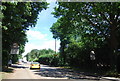
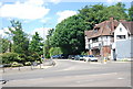
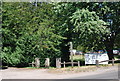
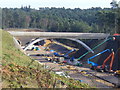

100 photos from this area
Area Information
Key information about the GU26 6SS including its size, population, and administrative classification.
- Area Type
- Postcode
- Area Size
- 3.0 hectares
- Population
- 1653
- Population Density
- 763 people/km²
House Prices in GU26 6SS
12
Properties
£999,222
Average Sold Price
£485,000
Lowest Price
£1,282,500
Highest Price
Showing 12 properties
| Address | Type | Beds | Baths | Last Sale Price | Last Sale Date | |
|---|---|---|---|---|---|---|
| Tomore Feje, 24 Pine Bank, Hindhead, GU26 6SS | Detached | 5 | 2 | £1,010,000 | Nov 2024 | |
| 28 Pine Bank, Hindhead, GU26 6SS | house | - | - | £1,282,500 | Jun 2022 | |
| Pentridge, 27 Pine Bank, Hindhead, GU26 6SS | house | - | - | £1,097,500 | Oct 2021 | |
| Hollyburn, 33 Pine Bank, Hindhead, GU26 6SS | house | 3 | - | £1,075,000 | Jun 2021 | |
| 26 Pine Bank, Hindhead, GU26 6SS | Detached | 5 | 3 | £1,260,500 | Jun 2021 | |
| The Conifers, 30 Pine Bank, Hindhead, GU26 6SS | Bungalow | 5 | 2 | £900,000 | May 2020 | |
| 22 Pine Bank, Hindhead, GU26 6SS | Detached | 4 | 2 | £782,500 | Apr 2019 | |
| 32 Pine Bank, Hindhead, GU26 6SS | house | 6 | - | £1,100,000 | Mar 2014 | |
| 31 Pine Bank, Hindhead, GU26 6SS | Bungalow | - | - | £485,000 | Nov 2010 | |
| 29 Pine Bank, Hindhead, GU26 6SS | Detached | - | - | - | - |
Page 1 of 2
Energy Efficiency in GU26 6SS
Amenities
Schools
| Rank | School | Type | Entry gender | Ages |
|---|
Explore more schools in this area
Go to Schools tabDemographics
Household Size
Two person
most common
Accommodation Type
Houses
most common
Tenure
75
majority
Ethnic Group
White
most common
Religion
N/A
most common
Household Composition
N/A
most common
Age
47
median
Adults (30-64 years)
most common
Household Deprivation
N/A
with no deprivation
NS-SEC
48
in Lower managerial occupations
Explore more demographic insights in this area
Go to Demographics tabPlanning
Planning Constraints
- Flood RiskPremium
- Ramsar Wetland SitesPremium
- Area of Outstanding Natural BeautyPremium
- Protected Nature ReservePremium
- Protected WoodlandPremium