Area Overview for GU26 6JD
Photos of GU26 6JD


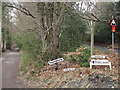
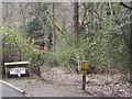
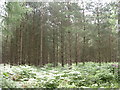


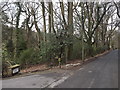
11 photos from this area
Area Information
Key information about the GU26 6JD including its size, population, and administrative classification.
- Area Type
- Postcode
- Area Size
- 68.7 hectares
- Population
- 1410
- Population Density
- 120 people/km²
House Prices in GU26 6JD
30
Properties
£1,031,775
Average Sold Price
£185,000
Lowest Price
£2,450,000
Highest Price
Showing 30 properties
| Address | Type | Beds | Baths | Last Sale Price | Last Sale Date | |
|---|---|---|---|---|---|---|
| Oakwood House, Hammer Lane, Grayshott, Hindhead, GU26 6JD | house | 7 | - | £2,450,000 | Jul 2025 | |
| Fairacre, Hammer Lane, Grayshott, Hindhead, GU26 6JD | Land | - | 4 | £1,540,000 | Apr 2025 | |
| Cobwebs, Hammer Lane, Grayshott, Hindhead, GU26 6JD | Detached | 4 | 2 | £995,000 | Apr 2024 | |
| Whitmore View, Hammer Lane, Grayshott, Hindhead, GU26 6JD | house | 4 | 2 | £790,000 | Mar 2023 | |
| Badgers Holt, Hammer Lane, Grayshott, Hindhead, GU26 6JD | Detached | 4 | 2 | £980,000 | Sep 2022 | |
| Westwinds, Hammer Lane, Grayshott, Hindhead, GU26 6JD | house | - | - | £1,270,000 | Sep 2021 | |
| Glebe Cottage, Hammer Lane, Grayshott, Hindhead, GU26 6JD | house | - | - | £803,000 | May 2021 | |
| Valeside, Hammer Lane, Grayshott, Hindhead, GU26 6JD | house | - | - | £1,150,000 | Apr 2021 | |
| Hammer Firs, Hammer Lane, Grayshott, Hindhead, GU26 6JD | Detached | 5 | 3 | £1,480,000 | Apr 2021 | |
| Bracken Hill, Hammer Lane, Grayshott, Hindhead, GU26 6JD | Detached | 4 | 3 | £1,422,834 | Oct 2020 |
Page 1 of 3
Energy Efficiency in GU26 6JD
Amenities
Schools
| Rank | School | Type | Entry gender | Ages |
|---|
Explore more schools in this area
Go to Schools tabDemographics
Household Size
Family (3-5 people)
most common
Accommodation Type
Houses
most common
Tenure
56
majority
Ethnic Group
White
most common
Religion
N/A
most common
Household Composition
N/A
most common
Age
47
median
Adults (30-64 years)
most common
Household Deprivation
N/A
with no deprivation
NS-SEC
30
in Lower managerial occupations
Explore more demographic insights in this area
Go to Demographics tabPlanning
Planning Constraints
- Flood RiskPremium
- Ramsar Wetland SitesPremium
- Area of Outstanding Natural BeautyPremium
- Protected Nature ReservePremium
- Protected WoodlandPremium