Area Overview for GU26 6DR
Photos of GU26 6DR

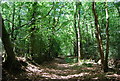
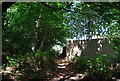
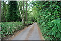

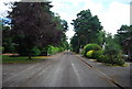
25 photos from this area
Area Information
Key information about the GU26 6DR including its size, population, and administrative classification.
- Area Type
- Postcode
- Area Size
- 29.0 hectares
- Population
- 1417
- Population Density
- 481 people/km²
House Prices in GU26 6DR
15
Properties
£842,993
Average Sold Price
£400,000
Lowest Price
£1,191,973
Highest Price
Showing 15 properties
| Address | Type | Beds | Baths | Last Sale Price | Last Sale Date | |
|---|---|---|---|---|---|---|
| Dragons Gate, Ladygate Drive, Grayshott, Hindhead, GU26 6DR | Bungalow | - | - | £1,191,973 | Jan 2025 | |
| The Glade, Ladygate Drive, Grayshott, Hindhead, GU26 6DR | Bungalow | 4 | 2 | £1,050,000 | Oct 2023 | |
| Mallorn, Ladygate Drive, Grayshott, Hindhead, GU26 6DR | Bungalow | - | - | £730,000 | Sep 2009 | |
| Ladygate Cottage, Ladygate Drive, Grayshott, Hindhead, GU26 6DR | house | - | - | £400,000 | Oct 2008 | |
| Woodside, Ladygate Drive, Grayshott, Hindhead, GU26 6DR | house | 6 | - | - | - | |
| Annexe, Ludshott House, Ladygate Drive, Grayshott, Hindhead, GU26 6DR | Flat | - | - | - | - | |
| Former Site Of Donec, Ladygate Drive, Grayshott, Hindhead, GU26 6DR | Retirement | - | - | - | - | |
| Ladygate, Ladygate Drive, Grayshott, Hindhead, GU26 6DR | Detached | - | - | - | - | |
| Ludshott House Cottage, Ladygate Drive, Grayshott, Hindhead, GU26 6DR | Detached | - | - | - | - | |
| Ladygate Bungalow, Ladygate Drive, Grayshott, Hindhead, GU26 6DR | Detached | - | - | - | - |
Page 1 of 2
Energy Efficiency in GU26 6DR
Amenities
Schools
| Rank | School | Type | Entry gender | Ages |
|---|
Explore more schools in this area
Go to Schools tabDemographics
Household Size
Two person
most common
Accommodation Type
Houses
most common
Tenure
89
majority
Ethnic Group
White
most common
Religion
N/A
most common
Household Composition
N/A
most common
Age
47
median
Adults (30-64 years)
most common
Household Deprivation
N/A
with no deprivation
NS-SEC
52
in Lower managerial occupations
Explore more demographic insights in this area
Go to Demographics tabPlanning
Planning Constraints
- Flood RiskPremium
- Ramsar Wetland SitesPremium
- Area of Outstanding Natural BeautyPremium
- Protected Nature ReservePremium
- Protected WoodlandPremium