Area Overview for GU24 9GN
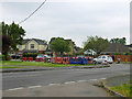
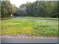
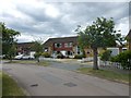
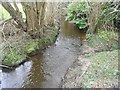
Photos of GU24 9GN

Area Information
Living in GU24 9GN offers a compact, residential experience shaped by its small cluster of homes and moderate population. With 2,788 residents spread across 3,059 square metres, the area maintains a close-knit community feel, typical of smaller postcode zones. The population density of 862 people per square kilometre suggests a balance between space and proximity, ideal for those seeking a quiet yet connected lifestyle. Most residents are adults aged 30–64, reflecting a stable demographic that likely prioritises family-oriented living. The area’s housing stock is predominantly owner-occupied, with 78% of homes owned by residents, indicating a long-term presence of families and individuals invested in the local environment. Daily life here is likely characterised by a mix of routine and community engagement, with nearby schools, shops, and transport links providing practical convenience without the bustle of larger urban centres. The absence of significant environmental constraints, such as protected landscapes or flood risks, further reinforces the area’s appeal as a safe, low-maintenance place to live.
- Area Type
- Postcode
- Area Size
- 3059 m²
- Population
- 2788
- Population Density
- 862 people/km²
The property market in GU24 9GN is characterised by a high proportion of owner-occupied homes, with 78% of properties owned by residents. This suggests a stable market where long-term residents are less likely to move frequently, potentially reducing competition for properties. The accommodation type is predominantly houses, which is unusual for a small postcode area but may indicate a mix of larger, family-friendly homes. This contrasts with areas dominated by flats or apartments, where rental demand is often higher. For buyers, the focus on owner-occupied housing could mean fewer rental properties available, though the presence of 78% ownership may also suggest a strong local demand for homes. The small size of the area and its immediate surroundings may limit the variety of properties available, making it essential for buyers to consider nearby zones for broader options. The lack of environmental constraints or planning restrictions further supports the area’s appeal for those seeking a low-risk, established property market.
House Prices in GU24 9GN
Showing 4 properties
| Address | Type | Beds | Baths | Last Sale Price | Last Sale Date | |
|---|---|---|---|---|---|---|
| 3 Brompton Gardens, West End, Woking, GU24 9GN | Detached | 4 | 3 | £1,182,000 | Feb 2025 | |
| 1 Brompton Gardens, West End, Woking, GU24 9GN | Detached | 4 | 3 | £1,050,000 | Sep 2020 | |
| 4 Brompton Gardens, West End, Woking, GU24 9GN | Detached | 4 | 2 | £827,500 | Jun 2020 | |
| 2 Brompton Gardens, West End, Woking, GU24 9GN | Detached | 5 | 3 | £1,070,000 | May 2020 |
Energy Efficiency in GU24 9GN
The lifestyle in GU24 9GN is supported by a range of nearby amenities that cater to daily needs. Retail options include M&S Gordon BP, Sainsburys Bisley, and The Southern Co-operative Co, providing access to groceries, clothing, and other essentials. These shops are within practical reach, reducing the need for long journeys to larger centres. The area’s rail stations connect residents to broader networks, facilitating travel for work, leisure, or socialising. The proximity to Fairoaks Airport adds to the area’s accessibility for those requiring air travel. While the data does not specify parks or leisure facilities, the absence of environmental constraints suggests open spaces may be available for recreation. Overall, the combination of retail, transport, and connectivity ensures a convenient lifestyle, allowing residents to meet their needs without leaving the immediate vicinity.
Amenities
Schools
Residents of GU24 9GN have access to a range of primary schools, including Holy Trinity CofE Primary School and Gordon’s School. The latter is notable for its Ofsted rating of outstanding, which highlights its high standards of education. The presence of both traditional primary schools and an academy like Gordon’s School offers families a choice between established institutions and potentially more specialised or innovative educational approaches. For parents, this mix of school types may provide flexibility in selecting a school that aligns with their child’s needs or their own preferences regarding teaching methods and facilities. The proximity of these schools to homes in the area reinforces the suitability of GU24 9GN for families seeking a reliable education system. The absence of secondary schools in the immediate vicinity means students may need to travel to nearby towns, but the rail links and road networks likely facilitate this transition smoothly.
| Rank | School | Type | Entry gender | Ages |
|---|
Explore more schools in this area
Go to Schools tabDemographics
The community in GU24 9GN is defined by its mature age profile, with a median age of 47 and the majority of residents falling within the 30–64 age range. This suggests a population that is largely established, with fewer young families or retirees compared to other areas. Home ownership is high at 78%, indicating a strong local presence and reduced turnover in properties. The accommodation types are primarily houses, which aligns with the area’s lower density and more spacious living arrangements. The predominant ethnic group is White, though the data does not specify further diversity metrics. The age and ownership patterns imply a stable, settled community with a focus on long-term residency. For buyers, this demographic profile may suggest a market where properties are held for extended periods, potentially offering more predictable value retention. The absence of specific deprivation data means the quality of life here is likely influenced by the availability of local services and infrastructure, which appear adequate for the population’s needs.
Household Size
Accommodation Type
Tenure
Ethnic Group
Religion
Household Composition
Age
Household Deprivation
NS-SEC
Explore more demographic insights in this area
Go to Demographics tabPlanning
Planning Constraints
- Flood RiskPremium
- Ramsar Wetland SitesPremium
- Area of Outstanding Natural BeautyPremium
- Protected Nature ReservePremium
- Protected WoodlandPremium